
|
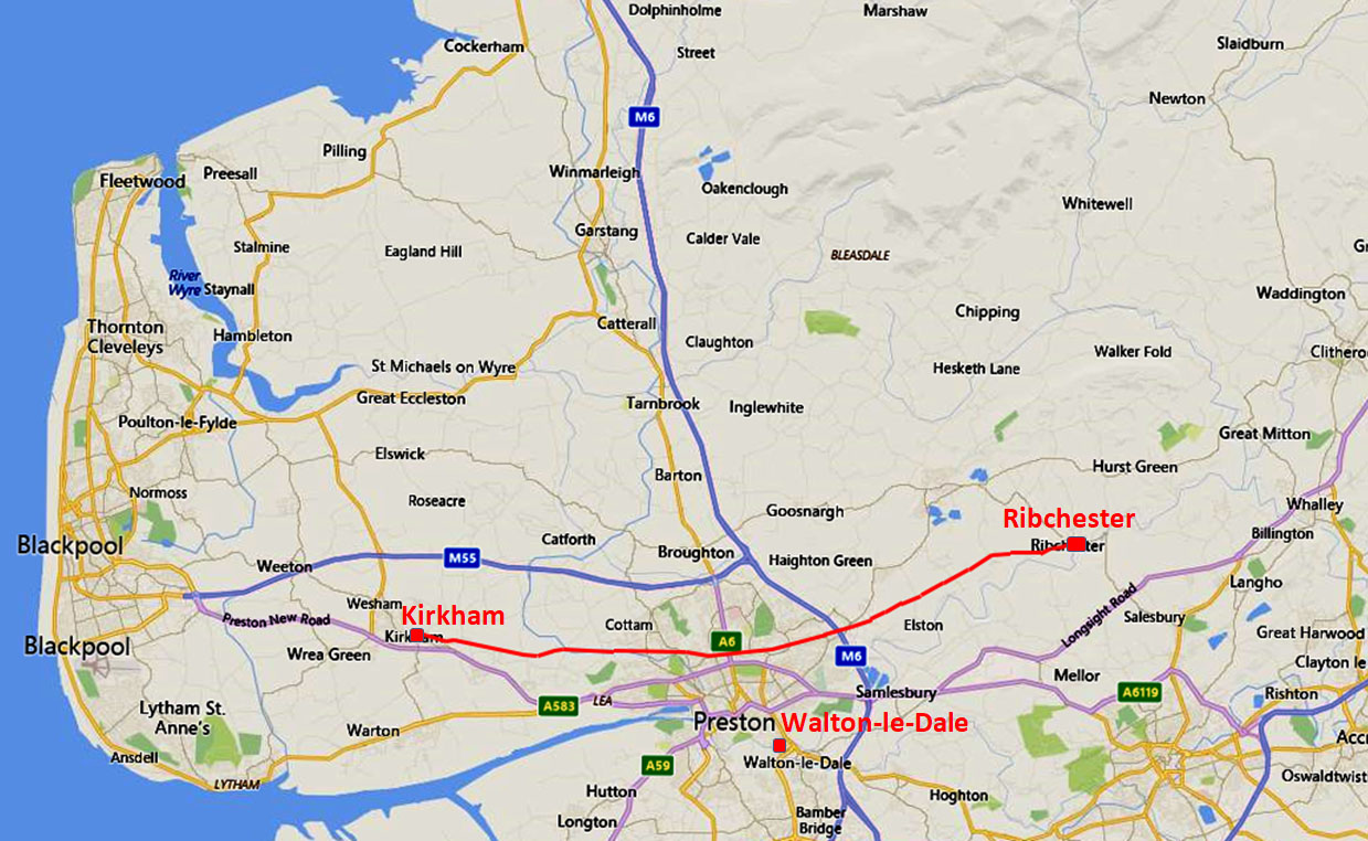
The Roman Road from Ribchester to KirkhamMargary Number: 703Distance: 14.5 milesThis road is well recorded on O.S. maps, at least from where it left the valley bottoms at Hothersall onwards to Kirkham. The route to Kirkham deviates from a straight course presumably to serve the Walton-le-Dale site as well as Kirkham. It would appear that this road was commonly known as Watling Street and is has one of the earliest documented use of this name. |
Historic County: Lancashire Current County: Lancashire HER: Lancashire
|
|
|
|
|
|
NEW 2024 -- 3D Lidar Video Flyover - Ribchester to Kirkham - the full route
|
||
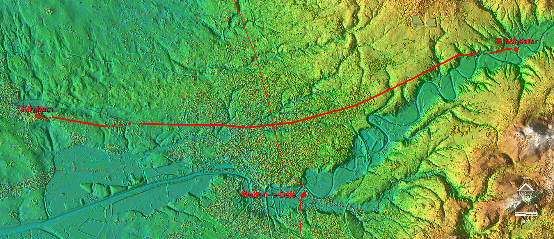
Lidar Image - Ribchester to Kirkham A perfectly straight road was clearly feasible but instead deviated to the south so as to also connect to the Walton-le-Dale site using the main north-south Roman road.. There is no evidence for the road beyond Kirkham. |
Click for larger view |
 |
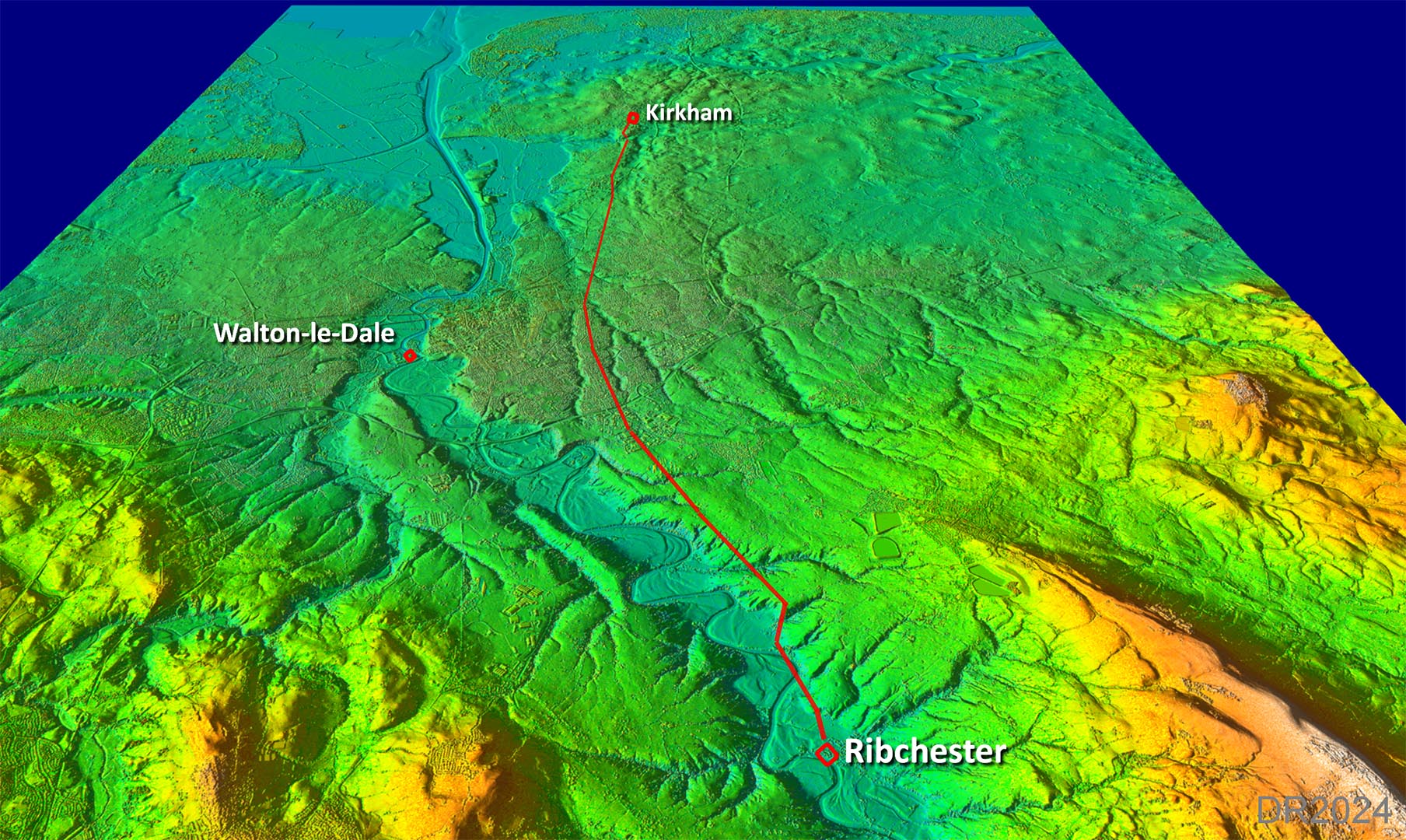
Oblique 3D Lidar View - Ribchester to Kirkham The equivalent oblique view to that shown above.
|
Click for larger view
|
 |
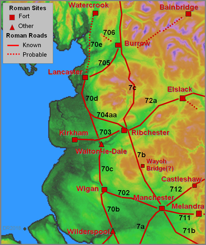
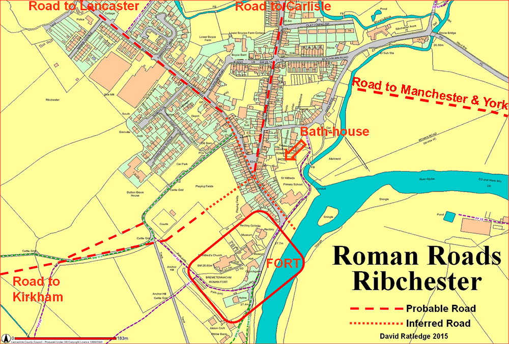
Ribchester Roman Road Map The road to Kirkham seems to have begun with two branches. The northern one presumably when the original fort was in operation - the southern one when the stone fort replaced the first one. |
Click for larger view
|
 |
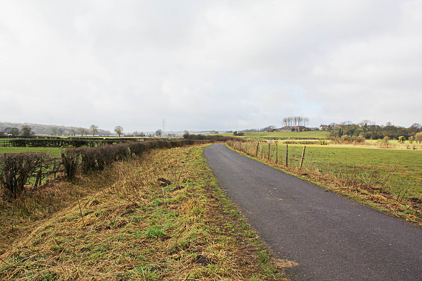
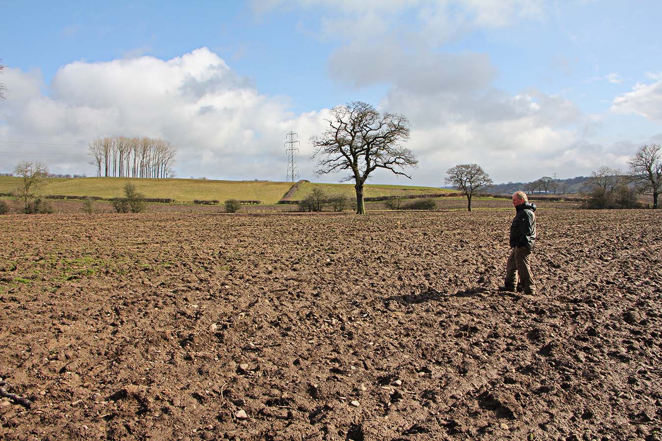
Farm Track to Parsonage Farm The initial alignment of the road is marked by the existing lane to Parsonage Farm (SD6486 3506) which sits on a very prominent agger - just about twice as wide as the modern track warrants. This alignment appears to be such so as to head for the high ground above the Ribble flood plain that begins at Parsonage Farm - in the distance in the image (right). Image: DR
|
Click for larger view
|
 |
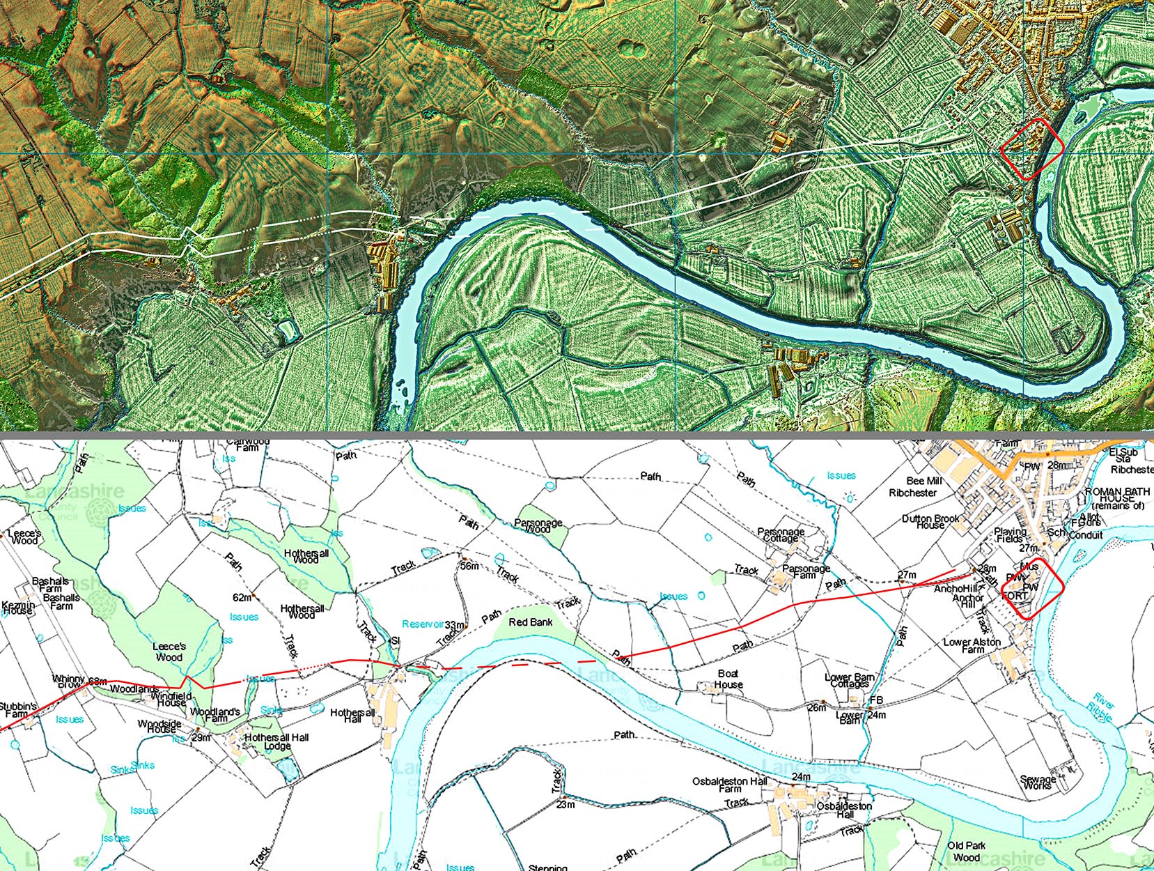
Lidar Image and Map - Ribchester to Hothersall The Roman line diverges off the track to Parsonage Farm at SD6468 3502 and Lidar shows faint traces of the agger as far as SD6441 3498, where the evidence becomes less obvious. There are two possible routes from here. If we extend the initial line forward then there are very clear traces beyond a modern landslip at Red Bank (SD6346 3492) but worryingly nothing shows in between. However, Lidar does show evidence for the southern option and this has been walked by my colleague Ian Milnes and myself - see next two images. On balance the southern route seems favourite and this route is shown right. Obviously movements of the river since Roman times have removed some of this route. From Hothersall Hall westwards there is sufficient Lidar evidence to complete the course to the previously known stretch beginning at Hothersall top, Whinny Brow. This route is approximately 100 metres to the north of the current Hothersall Lane (SD6274 3474). |
Click for larger view |
 |
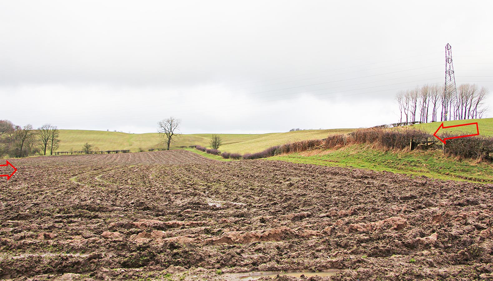
Agger at SD6405 3483 Unfortunately the fields beyond the Boat House had recently been ploughed. The swell of the agger in the hedge is obvious but the agger crossing the field is very subtle.
Image: DR |
Click for larger view |
 |
Stone Scatter at SD6385 3482 This is the last field before the river. All that is left after the ploughing is stone scatter on the line of the road. Nowhere else in the field were there so many stones. Thanks to Ian Milnes for spotting this telltale sign. Image: DR
|
Click for larger view |
 |
Hothersall - Whinny Brow (SD6231 3474) This is the beginning of the main alignment towards Fulwood and can be seen heading into the distance in this image (right). From here it is shown on the Ordnance Survey First Edition maps and Lidar confirms this is the correct route (see next image).
|
Click for larger view |
 |
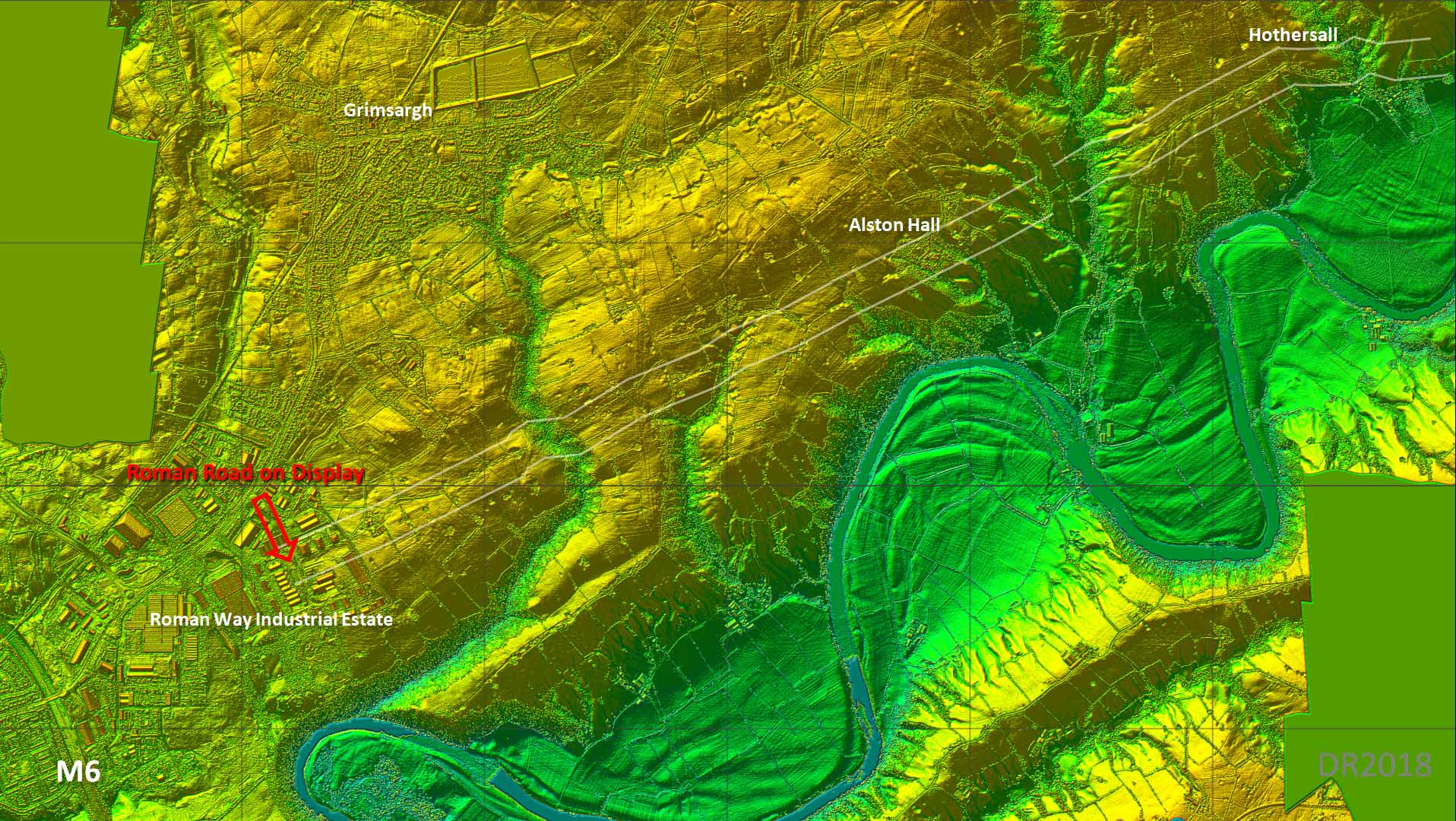
Lidar Image - Route from Hothersall to Ribbleton After Hothersall it passes directly under Alston Hall and was found when an observatory was built there - see report below. It has been suggested that a more logical direct route could have gone via Preston Road in Grimsargh and Lightfoot Lane in Fulwood. However, the OS course has been confirmed by excavation (Roman Way Industrial Estate) and by both aerial photography and now Lidar. It would seem it kept as close to the Ribble floodplain as practical and therefore facilitated a connection to the Walton-le-Dale site. |
Click for larger view |
 |
Excavation Report - Roman Road at Alston Hall The report (right) is from the Lancashire Archaeology Bulletin (LAB) 1977 and was carried out by the former County Archaeologist Ben Edwards.. |
Click for larger view |
 |
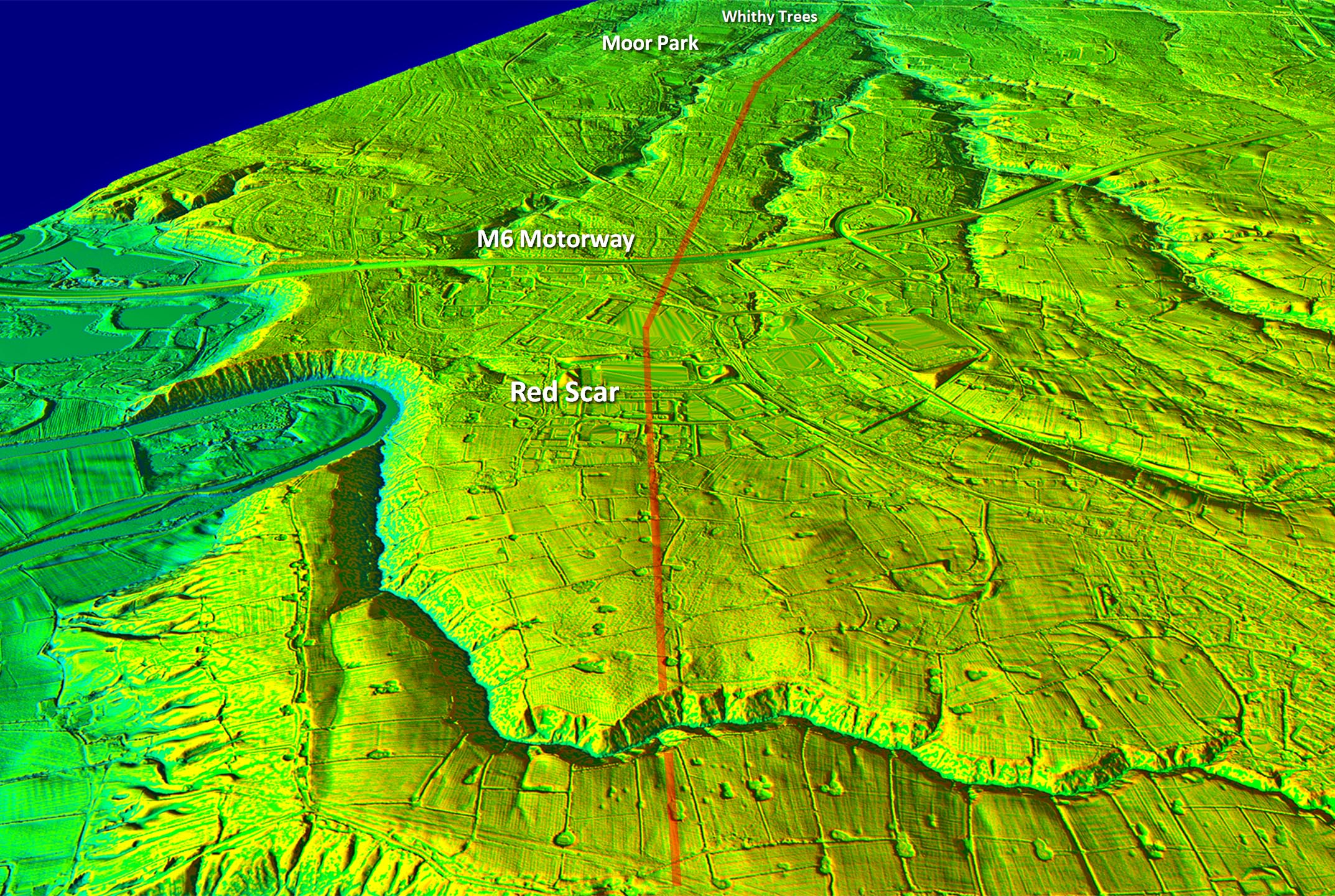
Oblique 3D Lidar View - Redscar to Withy Trees In this DTM view with all the buidlings and shrubery stripped off we can see why the road took the course it did. It skillfully targets the high ground between the 2 stream valleys as far as Whithy Trees. Superb surveying as you would expect from the Romans.. |
Click for larger view |
 |
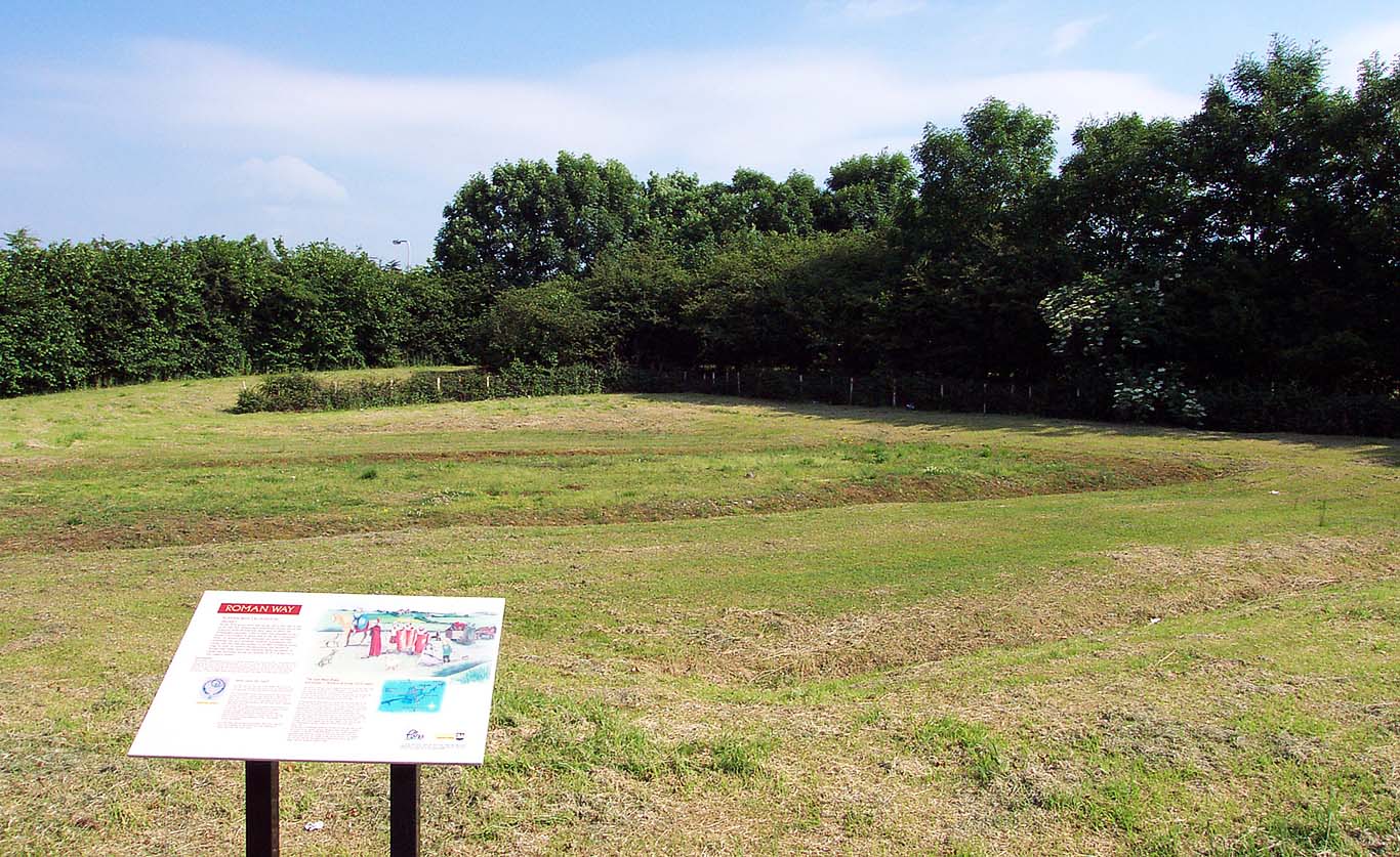
Roman Road Display 1 - Roman Way Industrial Estate A section was excavated at Red Scar (east of Preston) in 1977 directed by John Hallam and confirmed the line. This has been put on permanent display and is one of Lancashire's best kept secrets having no road sign indicating its existence. You can actually walk on a 2000 year old road surface and there is/was an informative display board. Despite being in the middle of an industrial estate it is a delightful location with a landscaped pond adjacent. Look for a pond on the right off Roman Way and the road is behind a hedge. Image: DR |
Click for larger view |
 |
Roman Road Display 2 - Roman Way Industrial Estate View across the road from the (former) display board. The near ditch is evident, then the agger with its own flanking ditches and just about visible (the grass changes colour) is the outer northern ditch. Council cut-backs seem to have to taken their toll and the last time I visited the display board had gone and the weeds had grown covering the road surface. It could be viewed as an experiment in seeing how quickly nature will reclaim an abandoned Roman road. Image: DR |
Click for larger view |
 |
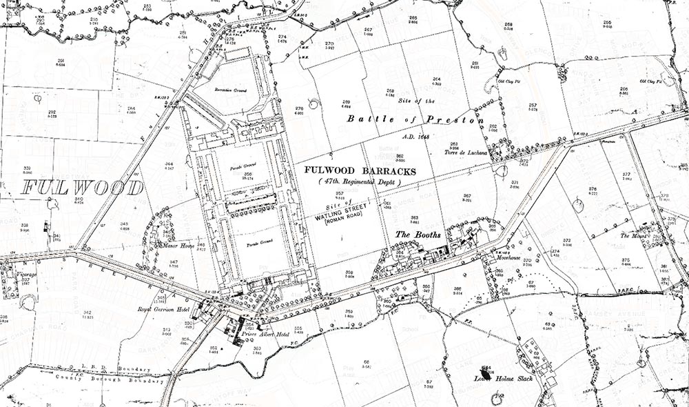
OS Map - original route of Roman road, Fulwood The most well-known section, Watling Street Road in Fulwood, is certainly on the line except for the modern kink around the Barracks.
|
 |
|
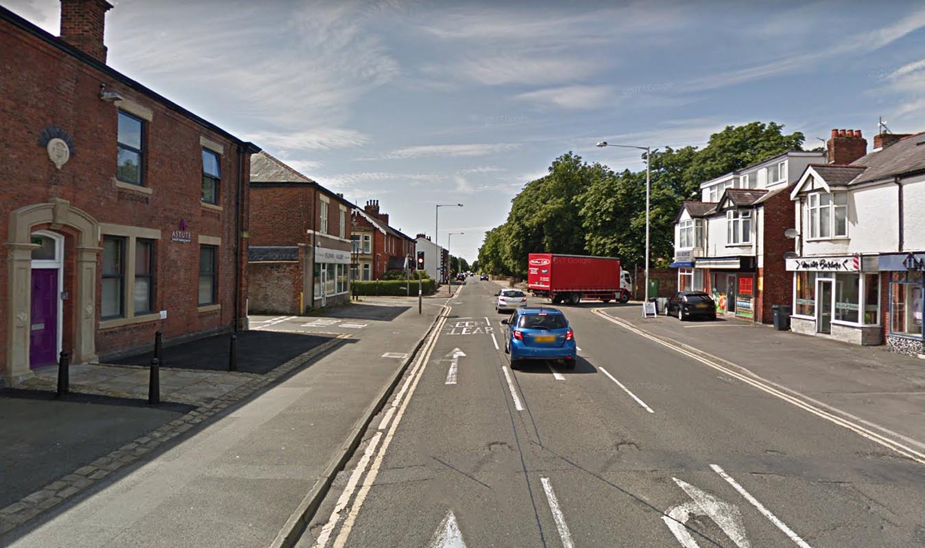
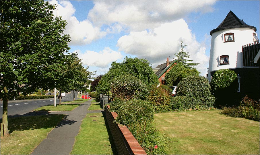
Watling Street Road, Fulwood Watling Street Road, Fulwood, was not laid out until Fulwood Moor was enclosed early in the 19th Century so it was out of use for perhaps over a 1000 years .Watling Street Road presumably utilised the remains of the Roman road as its foundation making construction pretty straight forward. It does indicate that the road was well known and also its common name. Another indicative name is also in the area i.e. Highgate. This is located on the right of the road in the distance of this image. |
Click for larger view |
 |
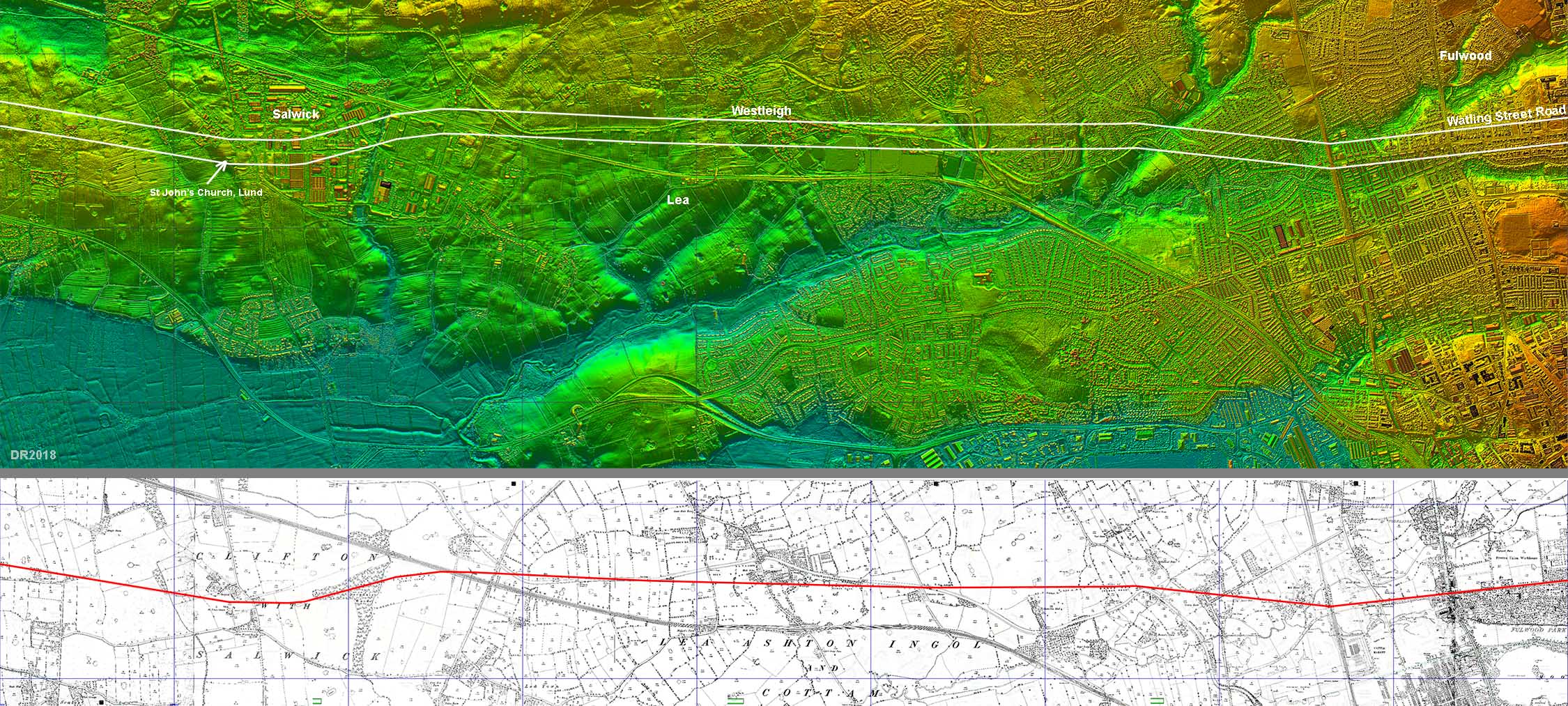
Lidar Image and Route Map - Fulwood to Salwick The route is shown on the OS First Edition maps (see Mario) and Lidar confirms this as correct. Doubts had been cast about the kink at Salwick but this appears to be true - well at least either side of the Salwick complex would appear to align. |
Click for larger view |
 |
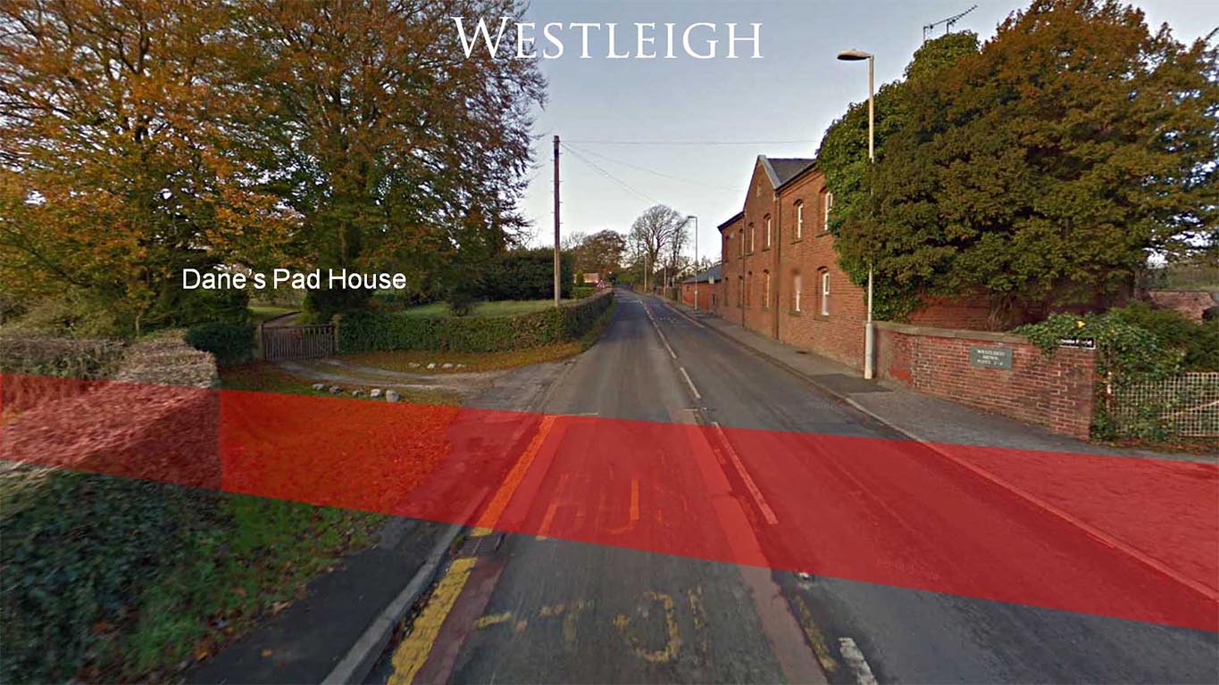
Westleigh - Roman road crossing Lea Road The Roman road crosses Lea Road at Westleigh. Dane's Pad House here was called Malt Kilns on Ordnance Survey 1845 and 1890 maps. Lancashire Archives has a charter dated to c.1285 which refers to a field in Lea called Wattelingstrete. This field must very near here as this is Lea Road after all. The charter clearly refers to our road and it is believed to be the second oldest reference anywhere in the country to a Watling Street. So rather than being called Dane's Pad, this stretch of Roman road from Ribchester to Kirkham was commonly known as Watling Street in antiquity. Image: DR
|
Click for larger view |
 |
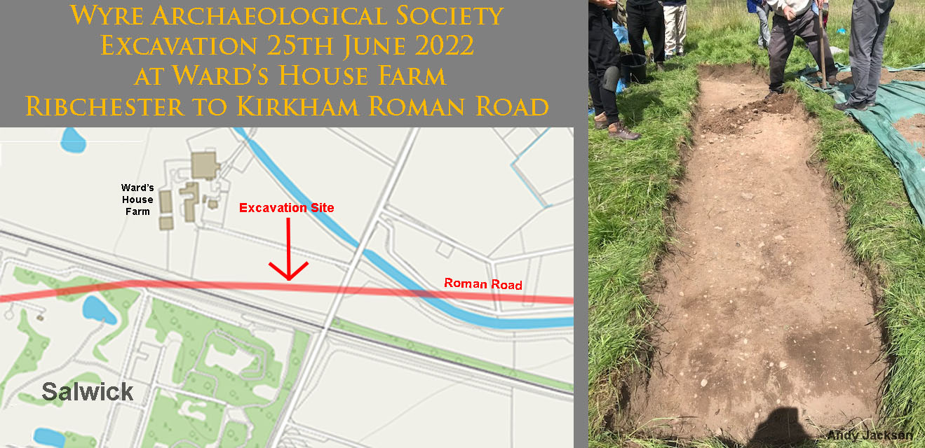
Ward's House Farm Excavation, Newton-with-Clifton, 2022 In 2022 Wyre Archaeology carried out an excavation just to the east of the Springfield/Salwick complex. The agger shows up sufficiently well in lidar to locate the road but indicated probably not in pristine condition. A 6 x 1 metre trench was opened across the top surface of the road. At the end of the dig the team dug a small pit down through the centre of the road but there was nothing substantial revealed . No larger foundation stones were present or agger layer structure. There was however a distinct camber. The construction was not unlike the road excavated east of Preston at Redscar. This could well be the furthest west the road has been excavated. Image: Andy Jackson
|
 |
|
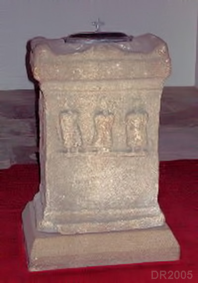
Roman Altar, St John's Church, Lund Having crossed the Springfield/Salwick industrial site, the Roman road passes to the north of St John's Church at Lund. Here a Roman Altar was reportedly found under the road and it now located inside the Church. Image: DR
|
 |
|
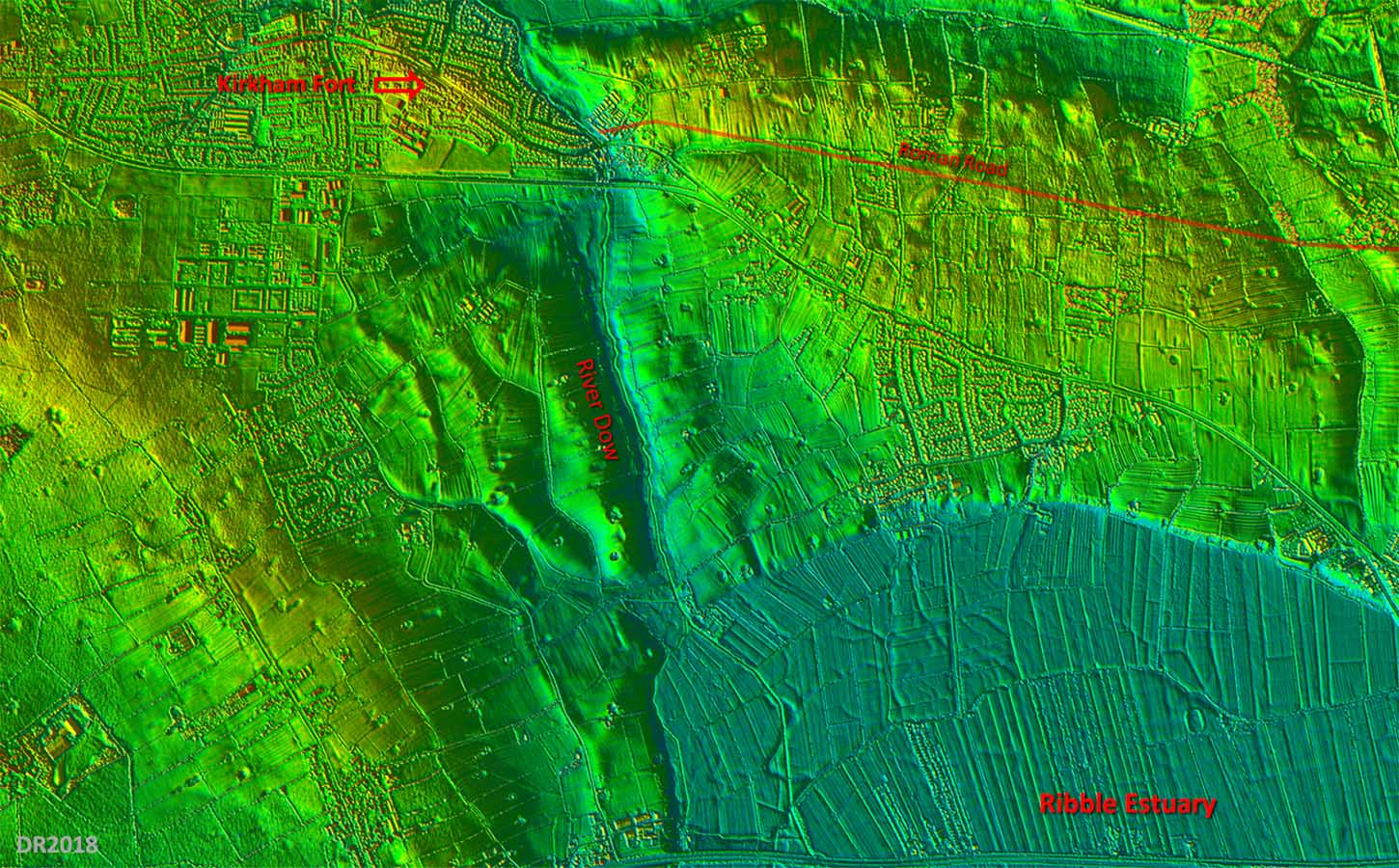
3D Oblique Lidar Image - looking West The fort at Kirkham was in the vicinity of Carr Hill near to the windmill and the course of the road is visible in the Lidar data as far as Dowbridge, Kirkham. The modern road from there and the Roman road perhaps share a similar course up to the fort site. There is the suggestion that the River Dow, or at least some part of it, could have been navigable in Roman times (see later). Note: Lidar shows the road clearly, except where covered by modern development, just about all the way from Ribchester to Kirkham. As we shall see later this is not the case west of Kirkham (The Danes Pad) where no supporting evidence can be found.
|
Click for larger view |
 |
Kirkham Fort Site, Carr Hill The fort at Kirkham was in the vicinity of Carr Hill near to the windmill. This is the highest point at Kirkham and presumably meant the fort was the dominate feature in this area. Image: DR |
Click for larger view
|
 |
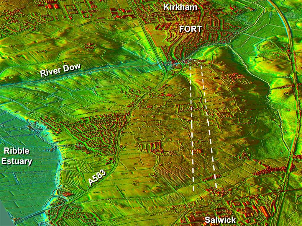
Lidar Image - Kirkham and the River Dow Was Kirkham a port? As mentioned above there has often been the suggestion that the River Dow could have been navigable in Roman times. In this lidar image the colour scheme has been chosen to indicate what could have been tidal in the Roman era. The Ribble Estuary comes (or used to come) remarkably close to Kirkham. With the discovery of the Roman fort at Burscough and a probable Roman road to Hesketh Bank on the opposite side of the estuary then Kirkham's location is starting to make some sense. Kirkham and Burscough forts were either side of the much larger then Ribble estuary. |
Click for larger view
|
 |
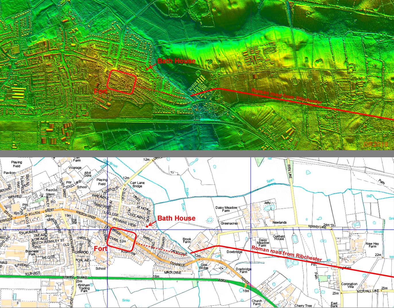
Kirkham Fort Site - Lidar and Modern Map The definitive work of Kirkham fort took place in 1994 during housing development south of the main road here by Howard-David & Buxton (Roman Forts in the Fylde, 2000). Their interpretation of 3 temporary forts followed by a "signal station/fortlet" was somewhat disputed by Bidwell and Hogson (The Roman Army in Northern England, 2009) which left the position, size and even its authenticity as a permanent fort less than certain. However, in a watching brief in 2009 by Oxford Archaeology North at 46 St Michael's Road (Zant & Eloy, 2010) the remains of a bath house were found (SD 4327 3203). It had a curving sandstone wall and pilae of a hypercaust (under floor heating system). This find certainly confirmed that Kirkham was indeed a permanent fort - temporary forts or signal stations are not known to have bath houses. The position and size shown for the fort is based on Zant & Eloy's figure 1 but seems to imply an optimistically large size for the fort. The bath house is just above the Dow Brook close to the site of the New England Spring. perhaps this (lost) spring was the water supply to the bath house? Wyre Archaeology have also carried out excavations in the locality in 2011 finding Roman "amphora, mortaria, Samian ware and bricks" in Myrtle Drive - see report. This would seem to imply a vicus here so Kirkham was a fort of some substance after all. |
Click for larger view
|
 |
|
|
|
Last update: July 2024 |
© David Ratledge |