|
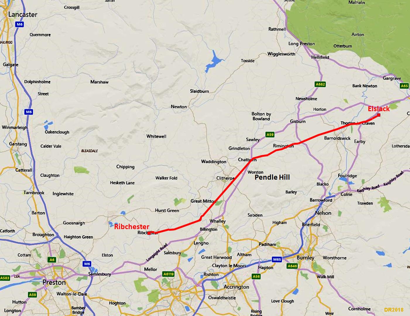
The Roman Road from Ribchester to ElslackMargary Number: 72aDistance: 20 milesThis Roman road is clearly targeted on linking Ribchester to York and it goes via the forts of Elslack and Ilkley. The direct line to the first, Elslack, is blocked by Pendle Hill so a route skirting around its northern slopes was devised. Its initial route as far as Chatburn keeps to the south side of the River Ribble. GIS analysis has shown the Romans knew the extent of the Ribble floodplain and sensibly kept well above it. |
Historic Counties: Lancashire & West Riding of Yorkshire Current Counties: Lancashire & West Yorkshire HER: Lancashire & West Yorkshire
|
|
|
|
|
|
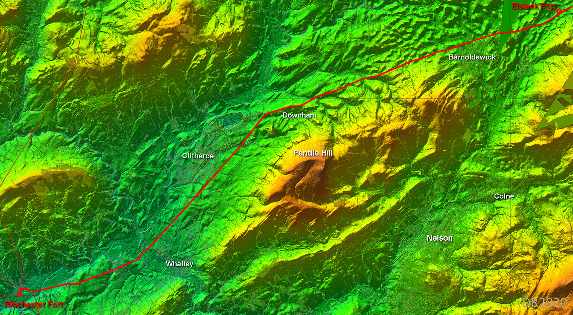
Lidar Image - Full Route Pendle Hill really dictated the route - direct was never an option. Downham seems to have been the key setting out point where the road changed direction. From Downham onwards the road had to adjuct to contours rather than being perfectly straight. |
Click for larger view
|
 |
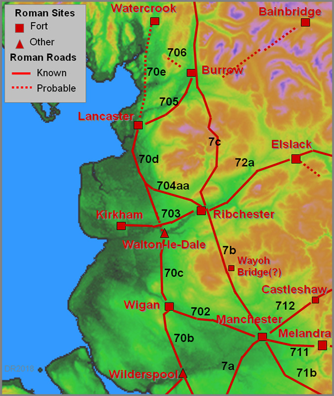
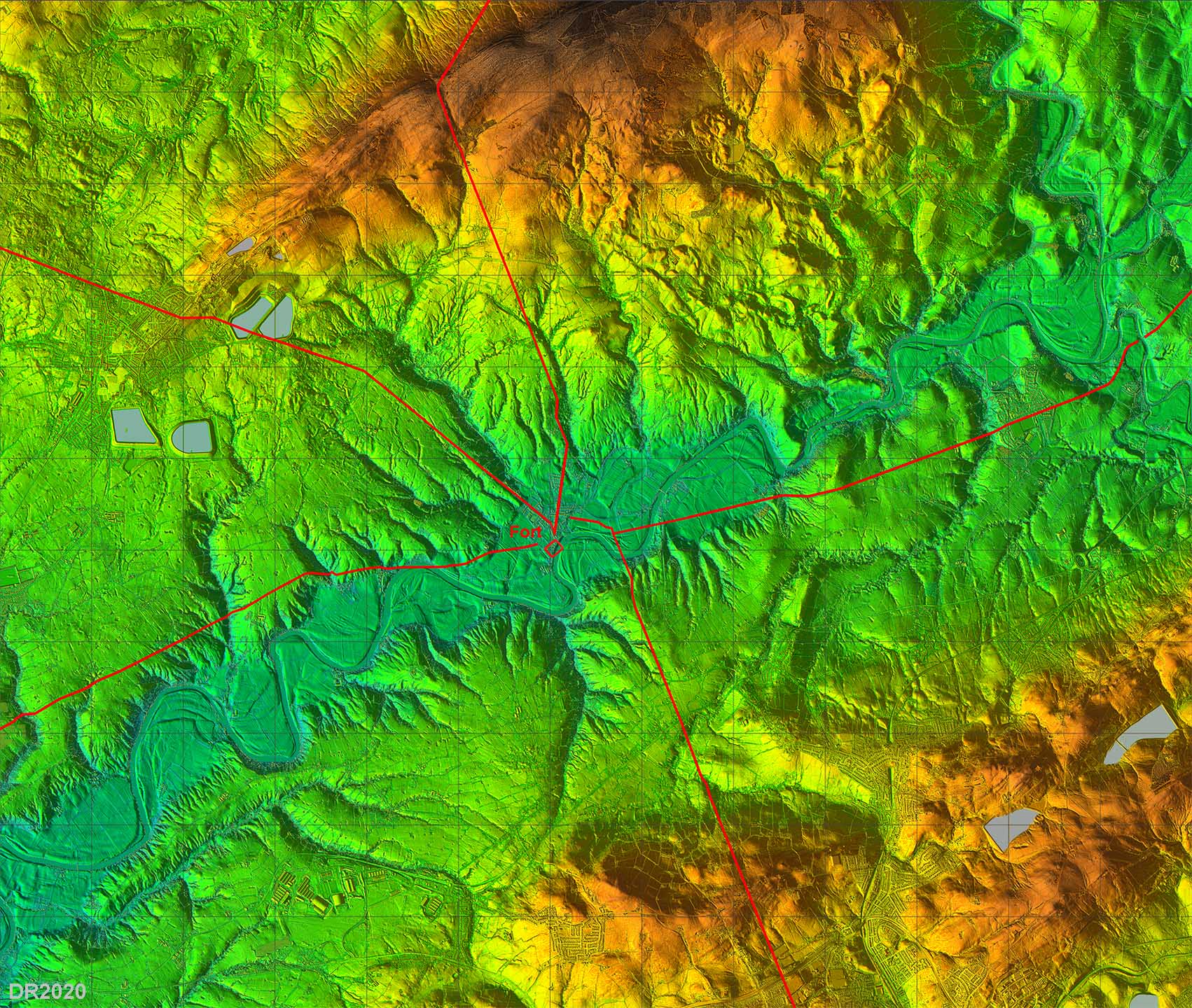
Lidar Image - Roman Roads around Ribchester Ribchester was probably Lancashire's most important road hub. |
Click for larger view
|
 |
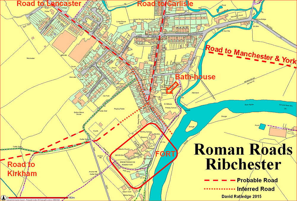
Ribchester Roman Detailed Road Map The original fort was further north than the later stone fort and the road layout was clearly designed/set-out for the first fort. Our road, Margary 72a heads out initially along Water Street before turning right beyond the Roman Bath House and heading for the site of the River Ribble Bridge. Note the OS line for the road shown on the map is incorrect. |
Click for larger view
|
 |
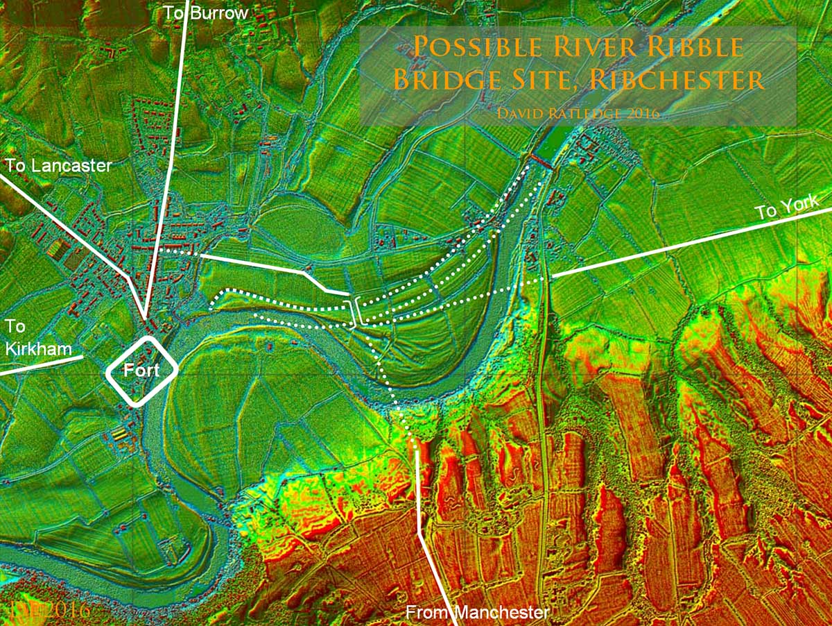
Lidar Image - Route to Probable River Ribble Bridge The site of the Roman bridge at Ribchester over the River Ribble has been the subject of much speculation but with the advent of Lidar we can now make an informed guess at to where it could well have been located. Obviously the Bridge would have been where all the roads converge. The road from Ribchester passes south of Beech House. Also visible is the route of the road down to the Ribble valley from Manchester and that of the road to Elslack (for York). Also visible are old channels of the River Ribble. See Margary 7b for more details |
Click for larger view
|
 |
3D Oblique Lidar Image - looking East The correct course of the road can be easily made out in this Lidar view. All 3 roads coincide at the bridge confirming this was its location. Current Ordnance Survey maps incorrectly plot the course of this road from Ribchester but Lidar has revealed the correct route out of the valley bottom passing Salesbury Hall. |
Click for larger view |
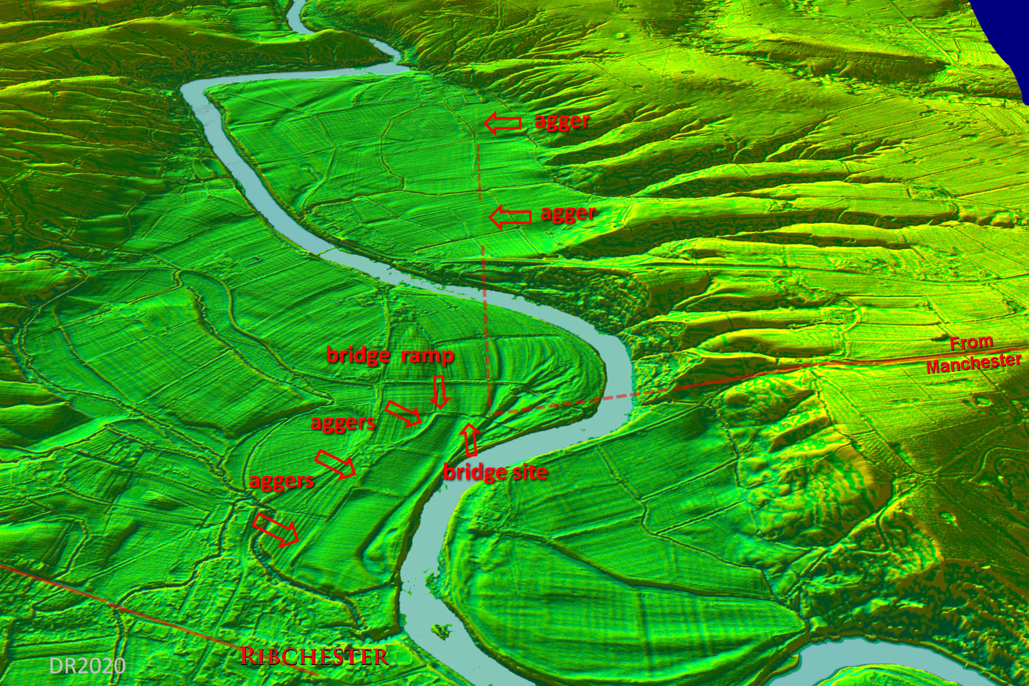 |
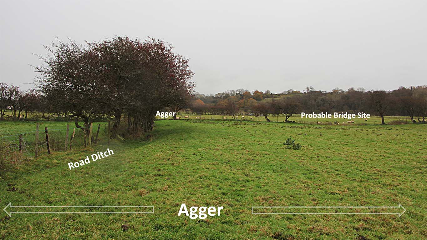
Agger passing Beech House - looking East This is on the link road from Ribchester to the probable River Ribble Bridge. The agger finishes at the fence line at the end of the field. It would have turned there and accessed the bridge via an approach ramp.
|
Click for larger view |
 |
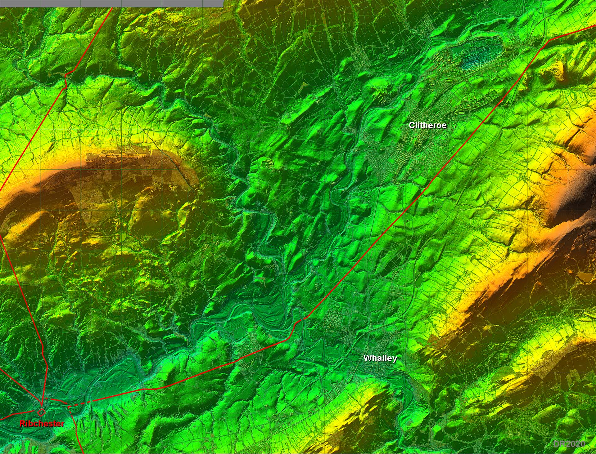
Ribchester to Downham Lidar Image - Route Logical route avoiding the flood plain of the River Ribble and threading its way around the hills. Notice how both Whalley and Clitheroe have developed about one mile away from the road. |
Click for larger view |
 |
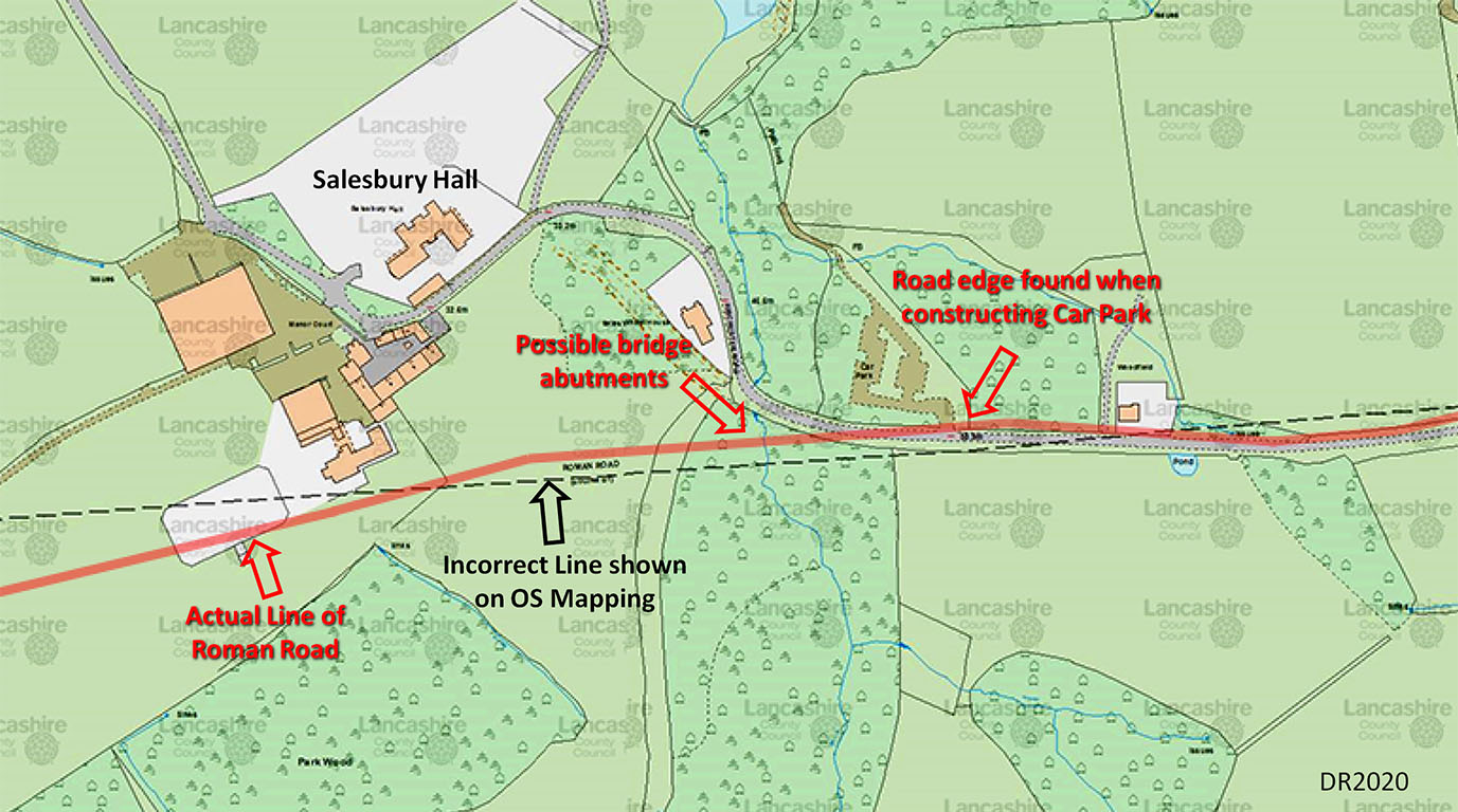
Ordnance Survey Map - Salesbury Hall and Marles Wood The line of the Roman road was found (SD6764 3560) when Marles Wood car park was constructed. Just the (north) edge of the road was found. At the entrance to the car park the line of the road has been marked by posts. The road itself is not visible. The site of the Roman Bridge over the stream through Marles Wood could be where Lidar indicates possible bridge abutments. |
Click for larger view |
 |
Fence Gate Farm Excavation - undated The road was excavated by A. A. White at Fence Gate Farm, map ref 368245/435698, probably in the 1970s judging by the van but his report is undated. The agger was found to be 13.5 metres wide and 0.85 metres thick. Somewhat unusually the foundation was yellow clay and the ditches were filled with sand. The yellow clay was topped with round sandstone cobble stones. Presumably a surface layer (not surviving) would have formed the surfacing. |
Click for larger view |
 |
|
NEW VIDEO - 3D Lidar fly-over along the line of this road into Ribchester from Dinckley i.e. east to west.
|
||
Lidar Image and Route Map - Salesbury West of Salesbury Hall the Roman Road is further south than that shown on OS mapping but east of Salesbury Hall then it is further north |
Click for larger view |
 |
3D Oblique Lidar Image - River Calder Crossing For the crossing of the Calder, near Whalley, the OS line is not quite correct - there is a slight dogleg to negotiate the river. I was surprised to see the large agger leading to the crossing had survived so well and it shows clearly on the Lidar imagery (right). Also visible is the cutting for the ascent up from the river bottoms on the east side of the river. |
Click for larger view |
 |
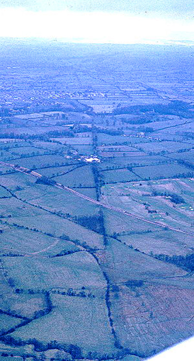
Aerial View - passing Clitheroe Golf Course Not the best quality image but worth including. The alignment heads south of Clitheroe and is well marked by field boundaries so shows up well.
|
Click for larger view |
 |
Lidar Image and Route Map - Whalley to Clitheroe Both Whalley and Clitheroe are off the line of the road. This was a major road (Kings Highway) lasting over 1000 years after the Roman left so why did these two towns avoid it? The reason of course is that these roads were often bad news. Any invaders, cattle rustlers or robbers could use the road for a smash and grab raid. Better to settle away from the road and keep out of harms way. |
Click for larger view |
 |
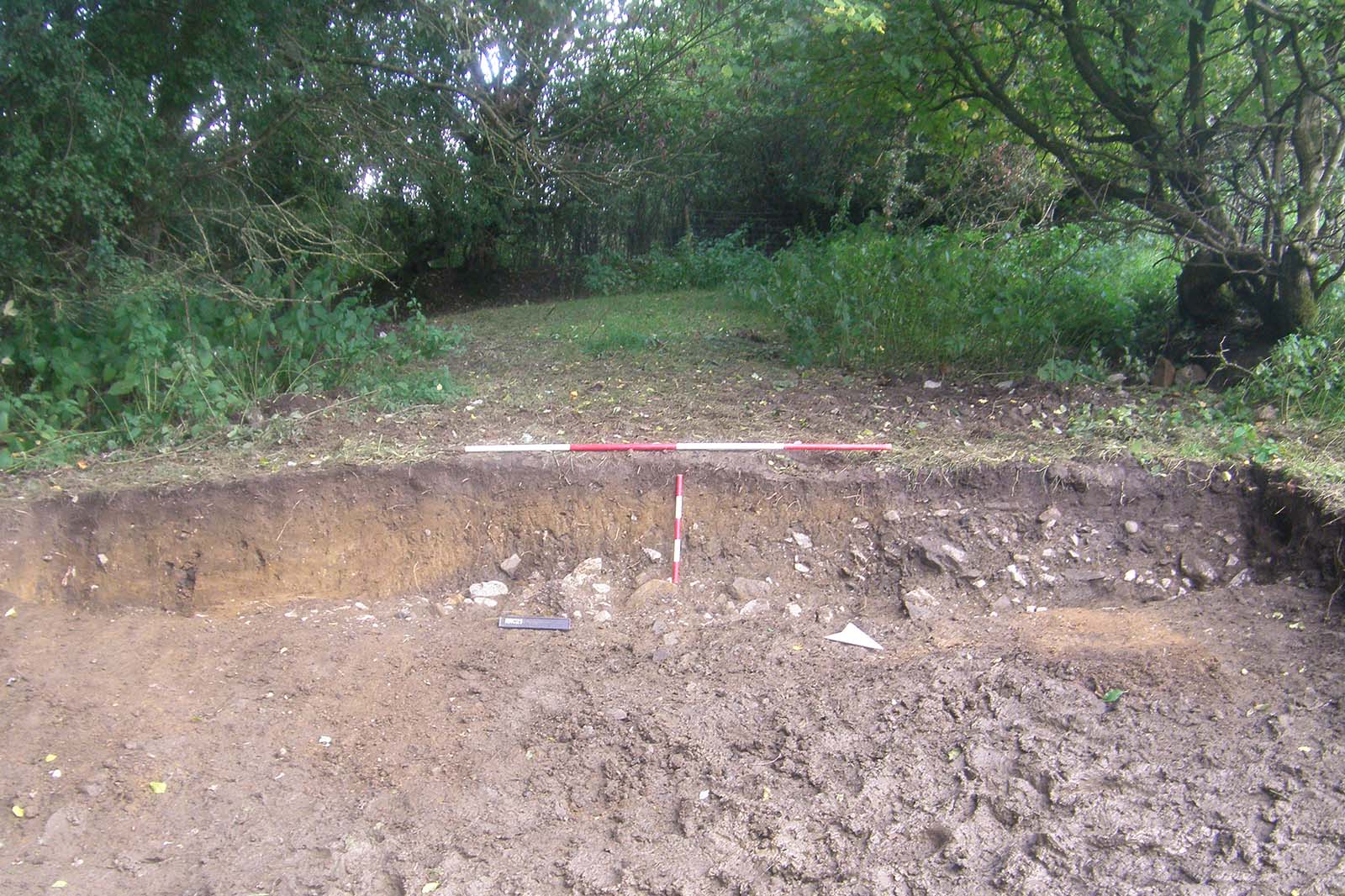
Excavation 2021, Hanson Quarry, Clitheroe, SD 76442 42803 Northern Archaeological Associates (NAA) were invited to conduct the investigation by the Pendle Hill Landscape Partnership (PHLP) with the co-operation of the site owners, Hanson Aggregates. Work took place over three weeks during September and October 2021, involving archaeologists from NAA and local volunteers from PHLP. The work consisted of an initial topographical and auger survey followed by an archaeological excavation of a section of the road. The site is located to the west of the A59, 2.5km north-west of the centre of Clitheroe, between Pendle Hill to the south-east and the River Ribble to the north-west. The excavation confirmed the presence and course of the road and provided evidence for the nature of its construction while allowing members of the local community to learn basic surveying, excavation and recording techniques Information kindly supplied by Catherine Ross, Project Manager ECUS |
Click for larger view |
 |
3D Oblique Lidar Image Having passed Pendle Hill and Worsaw Hill on their northern sides then the alignment changes Now it begins aiming more directly towards Elslack. This image is an animated gif - with and without the Roman road - so will be slow to load. |
Click for larger view |
 |
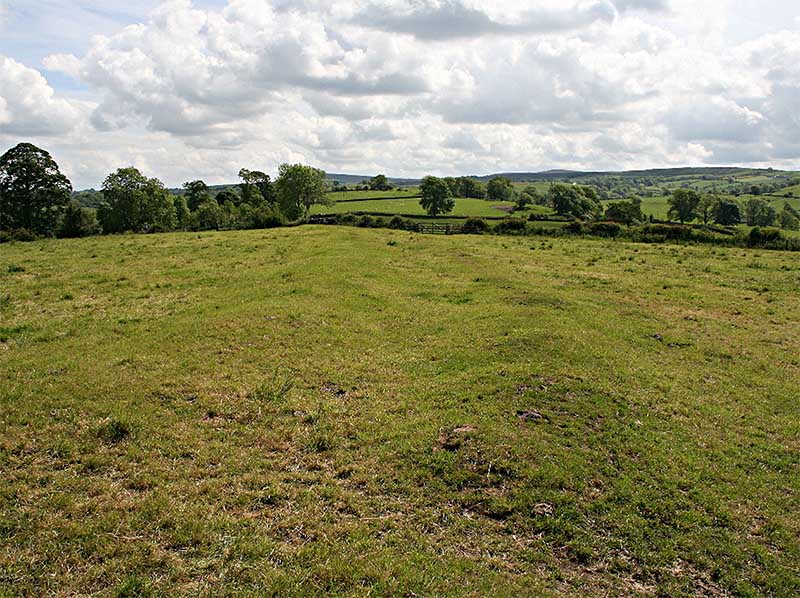
Roman Road Agger - Downham The new alignment towards Elslack is the one shown right and is part of a popular local walk (Downham Circular) It is highly recommended and follows this stretch of the Roman Road. |
Click for larger view |
 |
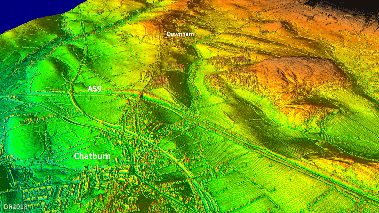
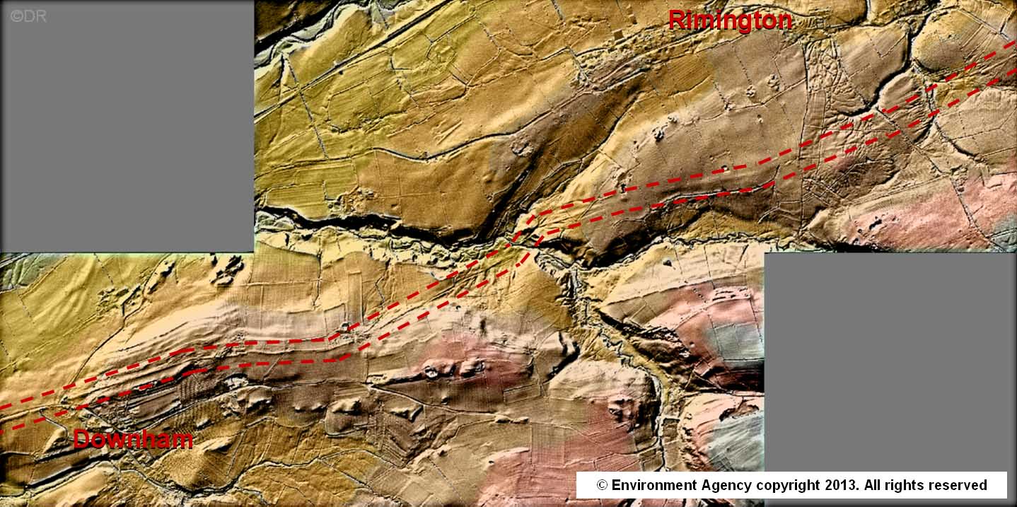
Lidar Image - Downham to Rimington The section between Downham and Rimington is one of the finest in the County. The engineering is superb as it angles down to cross the valley of Ings Beck and the route shows up very clearly in the Lidar data. |
Click for larger view |
 |
NEW 3D Lidar flyover video from Clitheroe to Howgill In which we fly past Chatburn, Downham and Rimington
|
||
Lidar Image - Barnoldswick to Elslack The course of the road approximately coincides with Brogden Lane and Greenberfield Lane passing Barnoldswick. The canal has destroyed a section but the route resumes over the (post 1974) Yorkshire boundary at Thornton-in-Craven.
|
Click for larger view |
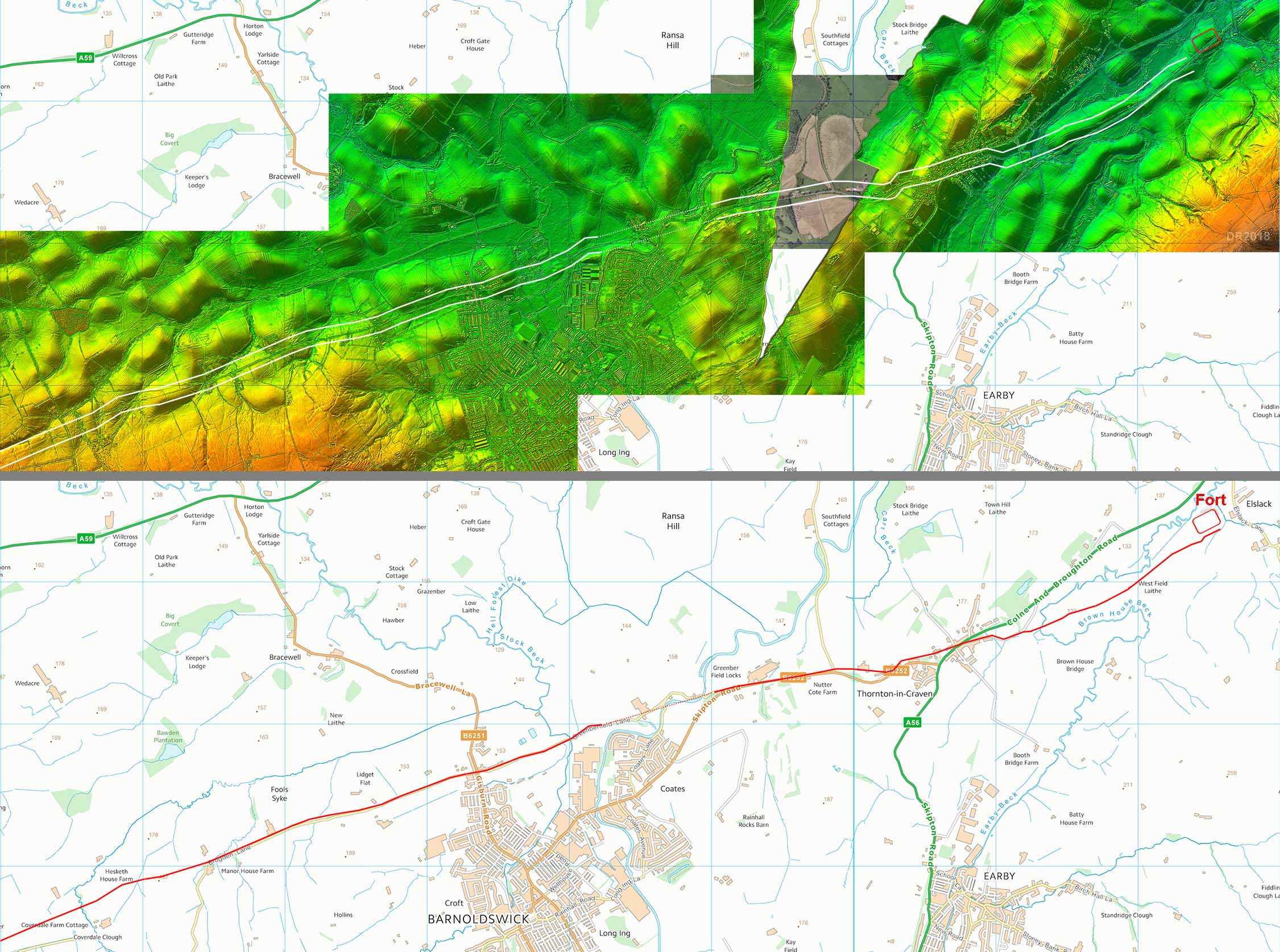 |
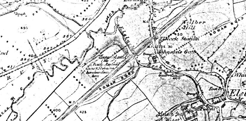
OS First Edition Map - Elslack, West Yorkshire Elslack fort was somewhat damaged by the Colne to Skipton Railway line which headed straight through it. The Roman road passes on the south side of the fort and can be seen heading further on into Yorkshire in the direction of Skipton. Note the name Burwen Castle. As we shall see in the next image, inside the Roman fort is a smaller fort with a corner entrance. Is this fort the origin of the Burwen Castle name? |
Click for larger view |
 |
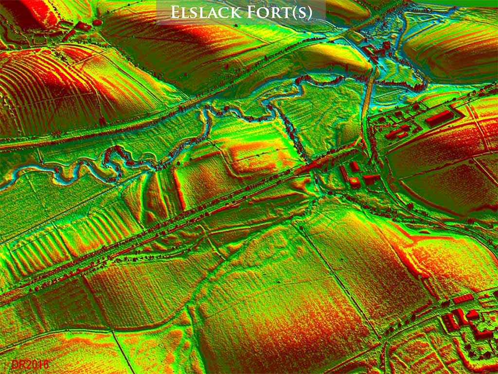
3D Oblique Lidar Image - Elslack Fort Hugh Toller, using Lidar imagery, discovered a fortlet inside the north-east corner of the Roman fort - right. The fortlet has an entrance in the corner which is typically not Roman - so presumably it is later. To the south of the fort, a small vicus with its own road, heading off the image at the bottom, is visible. |
Click for larger view
|
 |
|
|
|
Last update: April 2018 |
© David Ratledge |