
|
The Supposed Roman Road from Ribchester to Lancaster via StreetMargary Number: 704Distance: 21.5 milesNote: this web page has been kept for historical reasons. This road almost certainly does not exist and for the correct route - see the Ribchester to Catterall Road.Undoubtedly there would have been a Roman road between these two important centres. The search for it has been going on for over 150 years. To quote Ben Edwards, the former County Archaeologist, "It was inevitable that, in the search for a Roman road between Ribchester and Lancaster, the existence of a farm and bridge called Street should be noticed and pressed into service as evidence". From the publication of the OS First Edition Maps (c. 1846) showing a "supposed Roman Road" heading over Longridge Fell in the direction of Beacon Fell and Street then all manner or routes have been postulated. However, no hard evidence was ever found. As long ago as 1897, S Jackson (Secretary of Garstang Antiquarian Society) of Calder Vale, spent 10 years looking for the road without success. That search continued with various routes proposed either side of Beacon Fell but all going onwards via Street. |
Historic County: Lancashire Current County: Lancashire HER: Lancashire
|
|
|
|

|
|
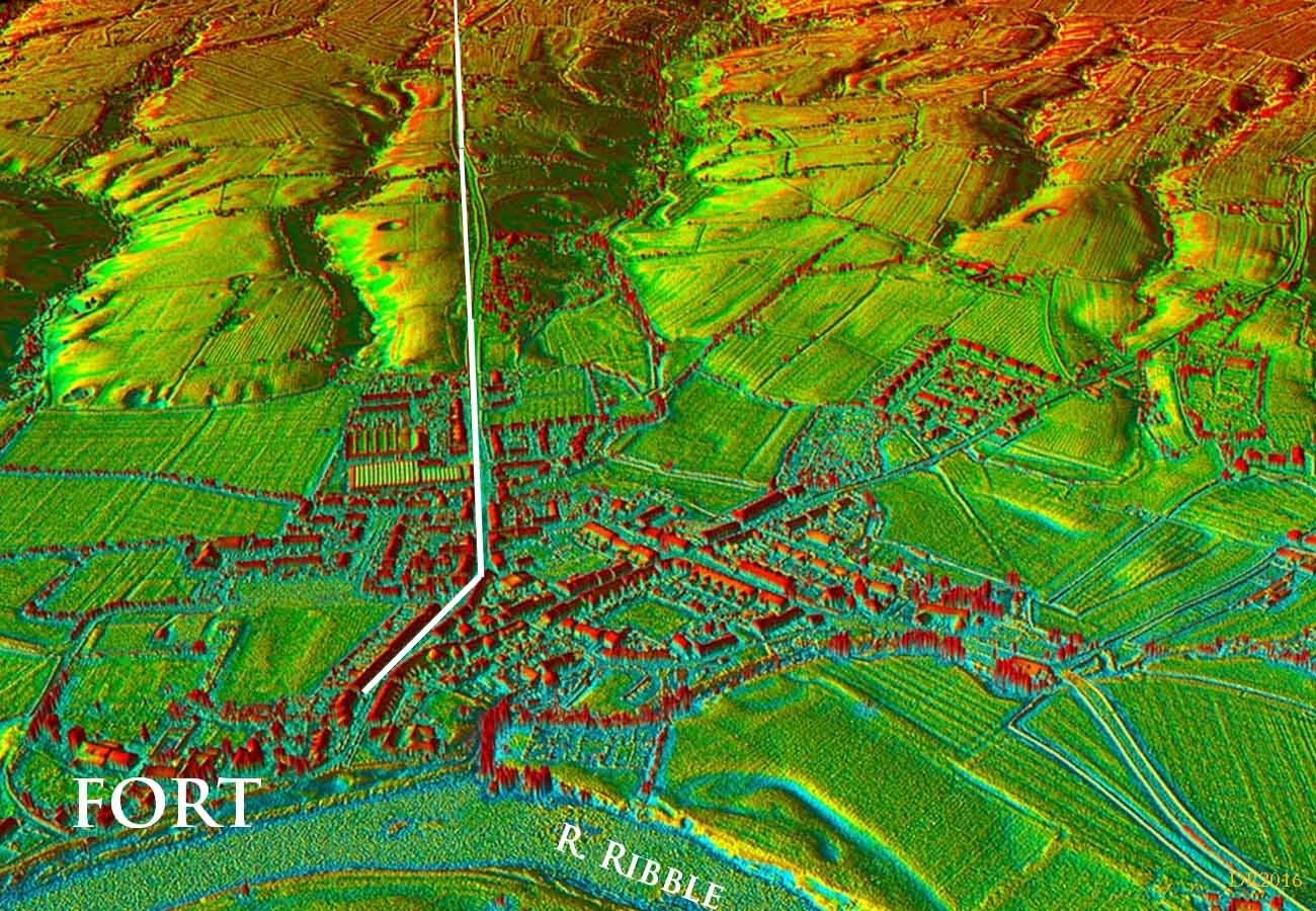
3D Oblique Lidar Image - Ribchester to Pinfold, Longridge Road No disputing the first mile. The B6243 indicates the line initially from Ribchester but the agger seems to have been slightly to the west of the modern road near Singleton House. In fact the front boundary wall of Singleton House aligns with the Roman agger rather than the modern road.
|
Click for larger view |
 |
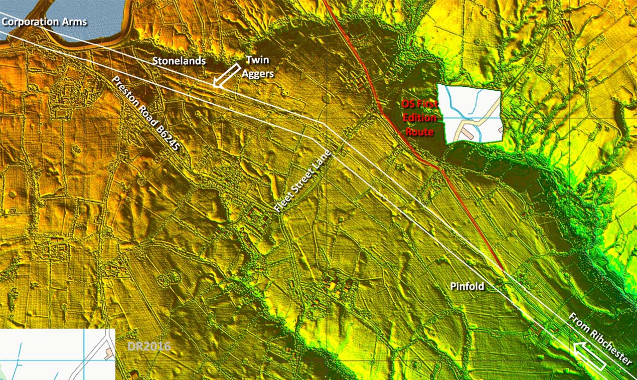
Lidar Image - Supposed Roman Road Course This first alignment is straight to beyond Fleet Street Lane. However, at Pinfold Farm & Cottages the OS First Edition route doglegs off to the East and is marked up and over the fell as "Supposed Roman Road" and then as "Ancient Causeway" beyond. This was always puzzling at it leads to a high crossing of Longridge Fell with a steep drop on the northern side. The basis for the OS change of direction seems to have been the "agger" at Ward Green - see next 2 images. |
Click for larger view |
 |
OS First Edition Map c.1845 - Ward Green East of the former Cross Keys Inn is what was taken to be the agger of the Roman road heading over Longridge Fell. This would seem to be the sole strand of evidence for this supposition. |
Click for larger view |
 |
Agger at Ward Green - adjacent to former Cross Keys Inn Feature at Ward Green, across the road from the former Cross Keys Inn. Is it an agger or depression? On my last visit it looks more like a hollow-way than a Roman agger. |
Click for larger view |
 |
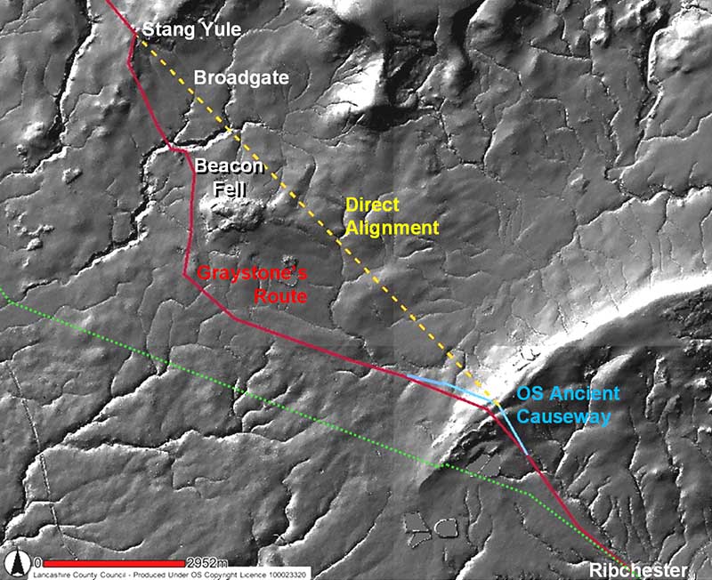
Relief Image - Longridge Fell to Beacon Fell Lidar coverage only goes as far as the crest of Longridge Fell so we have to rely on a relief map here. The green (actual) route has evidence but there is nothing supporting the OS route. Graystone was unaware of the OS first edition route and suggested a slightly lower route via Written Stone Farm before rejoining the OS route near the Derby Arms. The route proposed then went via Whitechapel and around the west side of Beacon Fell. One has to say if the road had gone to Whitechapel why would it then turn north over the hills when it would have been so close to the main north-south road? With hindsight it doesn't make much sense but we, me included, all thought it must do for many years. The "Graystone" route heading via Oakenclough was unable to take a direct course due to the intervening hilly terrain. This would have resulted in a distance to Lancaster which would have been little shorter, much more difficult to construct and traverse. It would appear the Romans took a very pragmatic approach and headed straight as they could to a road that was already there - the Walton-le-Dale to Lancaster Roman road. |
Click for larger view |
 |
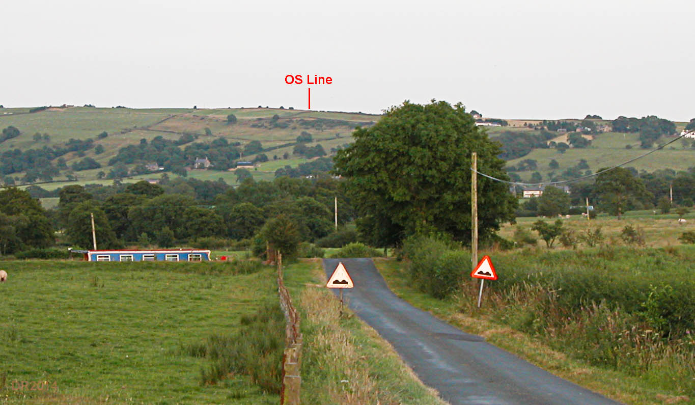
Holwood looking back to Longridge Fell This is the OS line for the road shown on the 6 inch First Edition (First Revision only) as "Ancient Causeway". It crosses Longridge Fell at a ridiculously high point and the drop on this side below "OS Line" marker on the photo is very steep. Margary very much doubted the OS route across the fell. He pointed out "these roads run slantwise" across steep slopes where as the OS route has a very steep drop off on the north-side of the fell. Note the "new" green route does exactly what Margary said - it runs slantwise to get up and crosses much lower. 2018 Update: "Farmer on Birks Brow confirms your statement that the OS Map route of a Roman Road dropping off the Longridge Fell as mis-information. He should know, he has farmed that land where the supposed route literally dropped of a sheer brow on to his pastures and has found no indication of a road" - personal comment passed on by Ian Milnes. Many thanks. I think this just about ends speculation on this "route".
|
Click for larger view |
 |
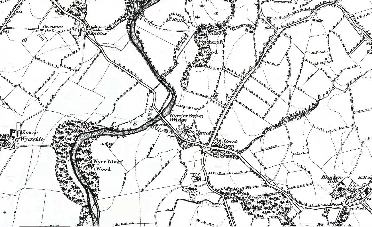
OS First Edition Map c.1845 - Street So what was the evidence at Street - does that stand up? To quote Ben Edwards, the former County Archaeologist ".....no valid evidence has yet been produced for the existence of a Roman road or bridge at Street". The old Street Bridge, shown on the map and downstream from the modern bridge was also discounted as being Roman by Ben Edwards.This is confirmed by the course of the Parish boundary here which clearly was based on the old meandering course of the River Wyre when parish boundaries were established (13th Century?). This doesn't even go near the old bridge!
|
Click for larger view |
 |
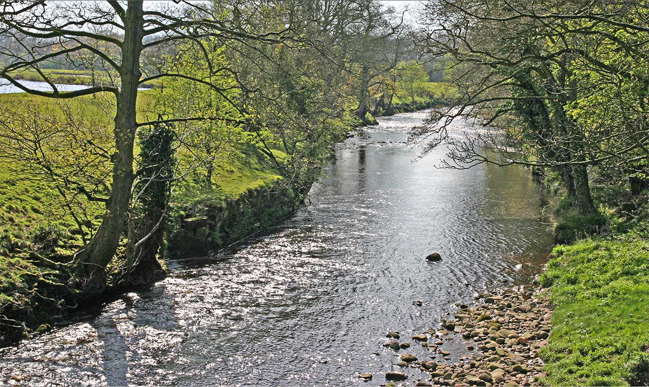
Old Bridge Abutment, Street
It is old and obviously has some large masonry blocks it in it but is it Roman? Putting my old bridge engineer hat I on I would guess at around 18th Century.
|
Click for larger view |
 |
Conclusion With the discovery of the direct road to Catterall (Margary 704aa), the case for The "Graystone" Route" (Margary 704) disappears. With hindsight, the fact that no real evidence had been forthcoming in 150 years of searching should have sounded the alarm bells. It is now obvious the Romans went from Ribchester to Lancaster via Garstang. I will finish with a comment from a letter by the farmer from Street Farm -"if all these people looking for a Roman road had asked me I would have told them there is no road here".
|
|
|
|
Last update: April 2018 |
© David Ratledge |