
|
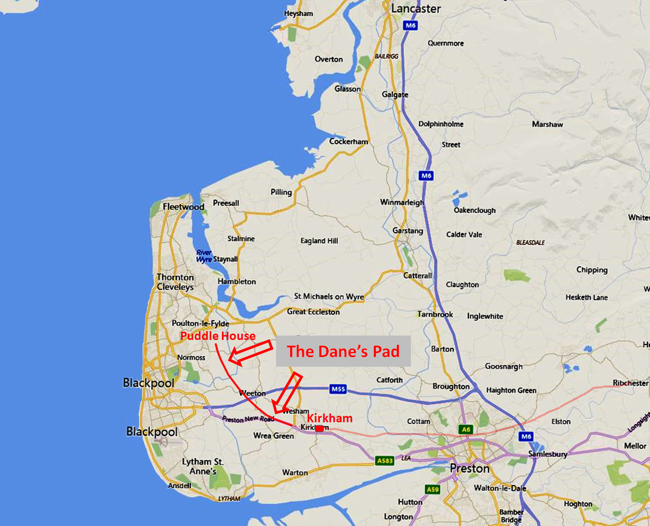
The Dane's Pad, Kirkham to Puddle HouseMargary Number: 703 (part of)Distance: ?? milesProbably the most debated "road" in Lancashire - the fabled Dane's Pad! Beyond Kirkham, the First Edition OS 6" & 25" maps showed a line, on a somewhat curving course, as far as Puddle House. The ultimate destination has often been claimed to be Portus Setantiorum listed by Ptolemy as located in the north-west. This "road" disappeared off most subsequent OS maps but made a reappearance on modern maps around 40 years ago. However, it must be said there is virtually no evidence supporting this road and Lidar too has failed to find any trace of its supposed route. |
Historic County: Lancashire Current County: Lancashire HER: Lancashire
|
|
|
|
|
|
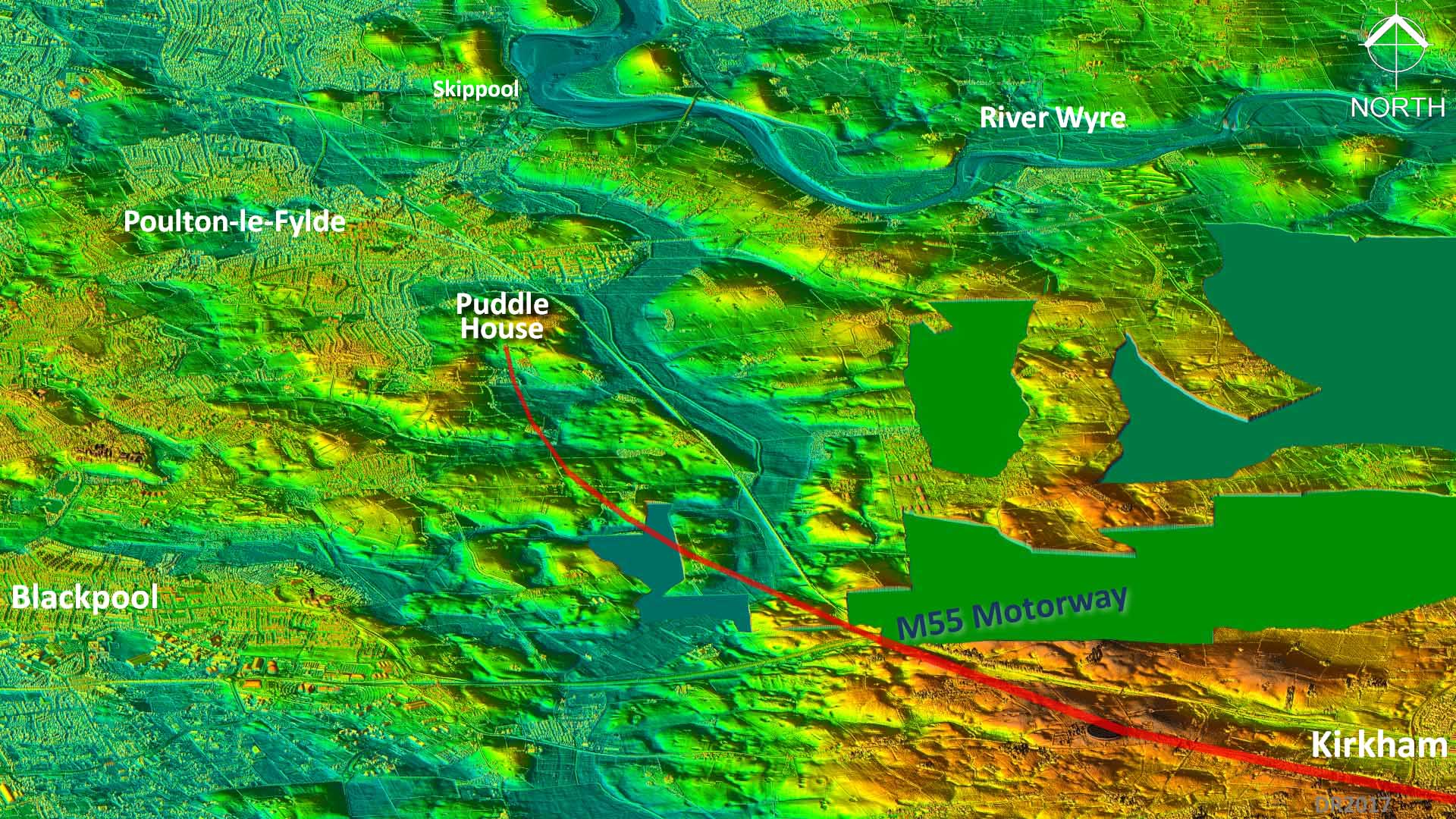
3D Oblique Lidar Image The shading is selected to show low lying land that was probably either water or marsh in Roman times. Would any Roman engineer plot this course for a road? If they needed to build one here then surely they would have kept to high ground and not headed anywhere near Puddle House. Running down the centre of this image is the Main Dyke - the glacial channel of the River Wyre. Its route to the sea was probably blocked in the glacial period forcing it south to join the Ribble estuary. Until the Main Dyke was drained in the 1700s getting across to Poulton or Blackpool must have been quite arduous and warranted the building of a large gravel embankment (see later).
|
 Click for larger view |
The Dane's Pad, A Roman Road to Nowhere? - Ted Lightbown The origin of the legend of a road here is almost certainly down to a document we now know was a forgery - The Itinerary of Richard of Cirencester (1755). Supposedly copied from original Roman documents, it included a road from the west coast (port of the Sistuntians) to York. From such "fake-news" sources are legends made! The greatest protagonist for the Dane's Pad road was to become the Reverend Thornber (History of Blackpool and its Neighbourhood, 1837) and it was likely through his efforts that the first OS surveyors showed the road. For a very unbiased review of all the evidence and history of this road then Ted Lightbown's booklet is the best place to start. It is a free download from Wyre Archaeology. Perhaps the sub-title gives a clue as to Ted's own view on the road's authenticity! |
Click for larger view |
 |
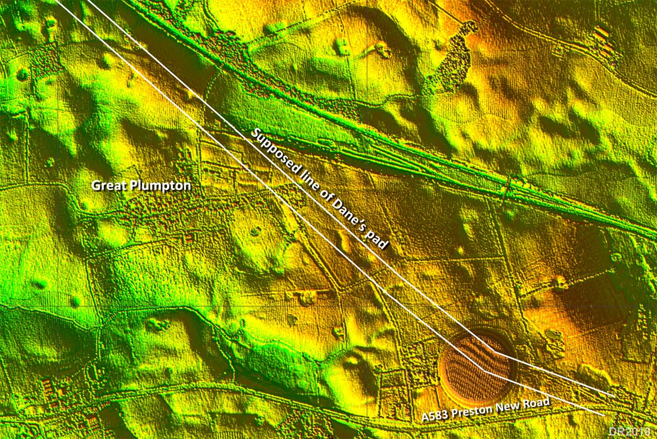
Lidar Image - Westby to Great Plumpton Using the latest Lidar imagery what is revealed? In short, I could find nothing at all supporting this route. I have searched from Westby to Puddle House using different illumination directions for the Lidar - all to no avail. Bearing in mind that the road east of Kirkham does show up in Lidar then finding nothing at all west of Kirkham is surely very significant. Right is typical of what is (not) revealed where the alignment passes Great Plumpton. Here Margary reported seeing an agger but nothing visible supports that.
|
Click for larger view |
 |
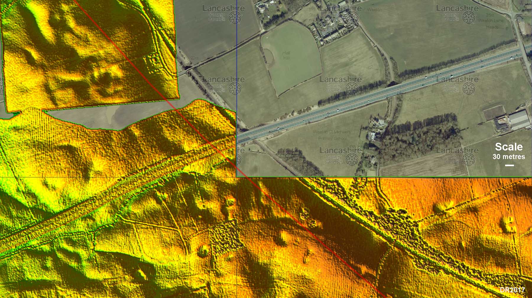
Rescue Excavation Report, M55 Motorway The reappearance of the road west of Kirkham on modern maps appears to be down to rescue excavations for the construction of the M55 Motorway carried out by Barri Jones in 1973 - later to become a Professor. The surviving report (not written by Jones) is very rudimentary and has several errors - it even has a grid reference that doesn't lie on the course of the M55. As rescue excavations it could only have taken place on the line of the motorway. However, he claimed to have found the road "30 metres west of the alignment suggested on the Ordnance Survey 6" maps". This would make it the only successful case where the road has been located by excavation. A possible explanation for the clay platform he found could be that, in this vicinity (SD378341) but admittedly 60 metres off line not 30, there was an old field boundary on the OS 6" First Edition, which had disappeared by the time of the 25" First Edition (c.1890). Perhaps it was the clay bank of this lost field boundary that was excavated? As we shall see in the next Lidar image there is nothing visible 30 metres west of the OS line. |
Click for larger view |
 |
Lidar (+aerial) Image - M55 Excavation Location Does Lidar show anything supporting the road line claimed to have been found by Barri Jones? The OS line is plotted in red and a scale gives the relative length of 30 metres. 30 metres west of the OS line, or any line for that matter, then nothing is visible. If this is the best (only) evidence ever found for the Dane's Pad then its existence is massively in doubt. |
Click for larger view |
 |
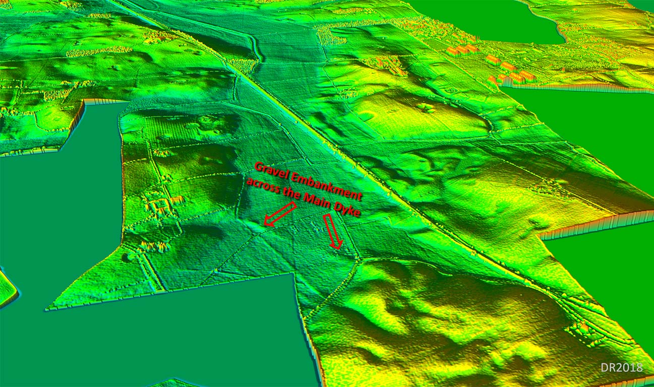
3D Oblique Lidar Image - Ancient Gravel Embankment, Mythop What Lidar does reveal is the remains of the gravel embankment across the Main Dyke channel at Mythop (SD371350). As we have seen, the Main Dyke channel was almost certainly a glacial route of the River Wyre. Until its drainage work in 1731 & 1741, it effectively made what was to become Blackpool and Fleetwood if not a true island then an area separated by a very marshy channel. So wet or marshy that it needed a huge gravel embankment to get safely across.. This embankment was a still large feature in Thornber's day and it not uncommon to label anything very old as "Roman". It would appear that this embankment was probably the source of the Dane's Pad "road" - extensions in both directions were imagined by Thornber and his contemporaries creating a "Roman road". |
Click for larger view |
 |
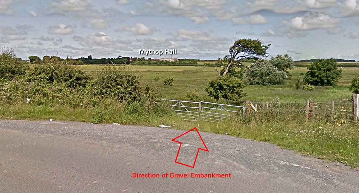
Gravel Embankment, Mythop - Modern View Today, gravel robbing has rendered the embankment all but invisible and the country lane that led to it now diverts (left in image) over Mythop Bridge.
|
Click for larger view |
 |
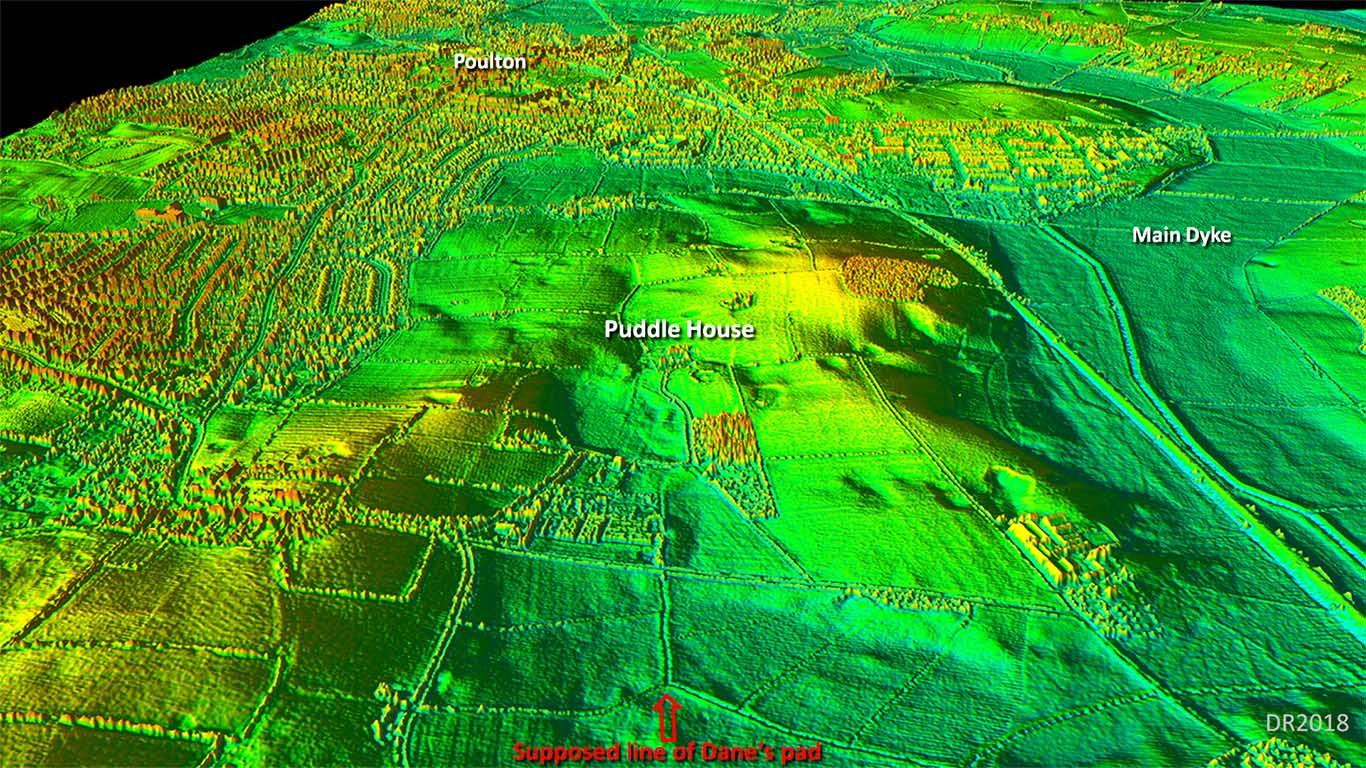
3D Oblique Lidar Image - Puddle House A totally unbelievable course for a Roman road. The area south of Puddle House was almost certainly marsh in Roman times and they would have had more sense than to take this route. |
Click for larger view |
 |
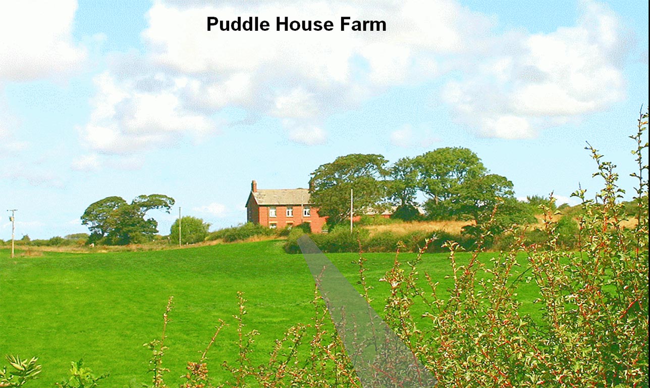
Puddle House Farm Puddle House is on higher ground but the area in front of it would have been marsh until it was drained in modern times.. Shaded gray is the supposed final length of the Dane's Pad. |
Click for larger view |
 |
Conclusion
If a port on the Wyre (Skippool) was the destination then a direct route from Kirkham via the high ground of Weeton and Singleton would have been shorter, drier and more logical. However, I have been unable to locate a road taking any course to the Wyre area. But I guess the speculation on the Dane's Pad and Portus Setantiorum will continue for many years to come! |
|
|
|
Last update: April 2018 |
© David Ratledge |