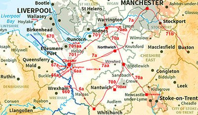
cheshire map

The Roman Road near Holt

Margary Number: 660

Distance: 3 miles

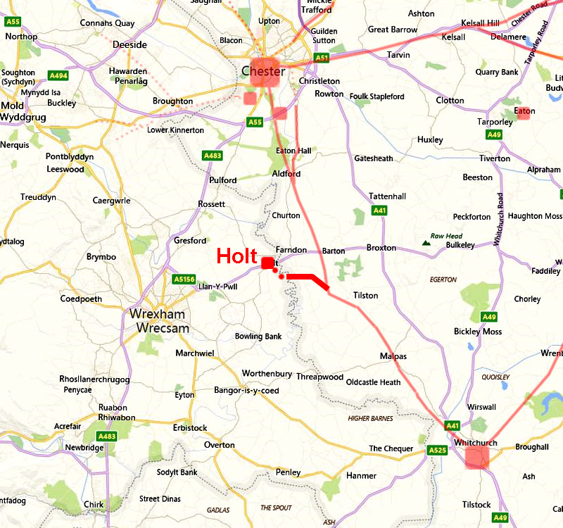
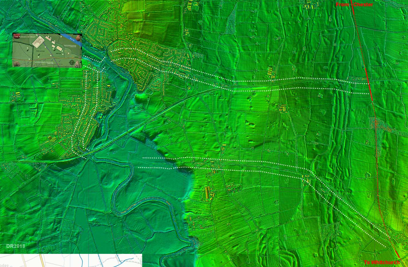
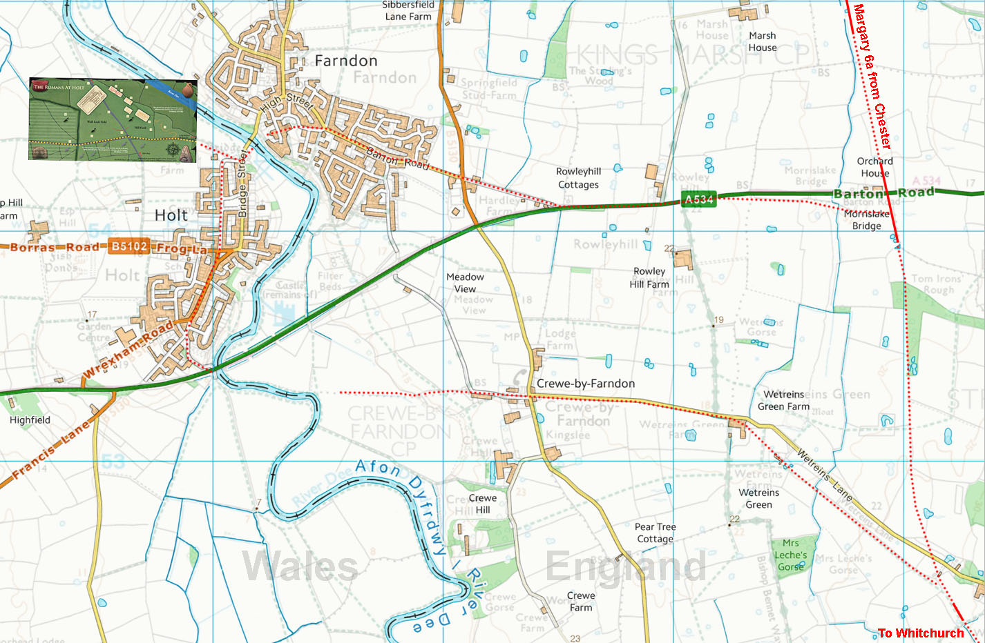
A route was suggested by Margary from Morrislake Bridge to Holt via Farndon and crossing the River Dee near to the modern bridge. A second option is also evident from the Lidar data further to the south. This leaves Margary 6a near Wetreins Green and heads west for crossing of the Dee before presumably passing northward through modern Holt. It is very unlikely that both would have co-existed - two river crossing make little sense. Which, if either, is correct is open to debate.

Note the Holt site is in Wales.


Historic Counties: Cheshire & Clywd/Denbighshire

Current Counties: Cheshire & Wrexham

HER: Cheshire & Wrexham


routemap

cheshire map


Holt Tilery - Grimes Map & Lidar

Holt Tilery was excavated by Acton in 1907-15 but his notes were lost and it was Grimes in 1930, using what he could salvage of Acton's plans and photos, that produced the report. The findings included 6 kilns and associated buildings including a barrack block. Grimes' plan is overlaid on a Lidar image. Not a lot corresponds but given the complicated history that is not totally unexpected. However, there is no doubt this was a major industrial site supplying Chester with tiles and pottery. He suggested an east-west road across the south side of his site but again this is not too convincing in the Lidar data. A prominent feature is visible on the Lidar image - marked with a question mark.

The site must have had road connections to Chester but probably also made use of the river to transport the heavy goods to there.

Recently a possible Roman Fort has been suggested at point 9 on the map. It is more evident right before zooming in at full scale. At full size it is much less convincing.

Reference: William Francis Grimes, A Pottery and Tilery of the Twentieth Legion at Holt, Cymmrodorian Society Transactions vol.XLI (Cardiff 1930).


Click for larger view


tilery lidar

Lidar Image - Fardon & Holt

The two possible routes connecting Holt to main north-south road from Chester to Whitchurch. The southern one would obviously suit a connection to Whitchurch and the south rather than Chester.

Click for larger view
lidar

Lidar Image - Fardon & Holt

Map matching the above Lidar image with the suggested routes marked up. More evidence is really needed to confirm either as a Roman road.


map options

Oblique 3D Lidar Iamge - Possible Fort, Fardon

North-west of Fardon, in a horseshoe bend in the River Dee, is a possible Roman fort. There is perhaps traces of a road east from the fort but I would regard this as low confidence as it only appears in a single field. No other signs of a connecting road were spotted.

The inset plan gives the scale of the fort


fardon fort

Back to homepage

Last update: July 2018

© David Ratledge