
|
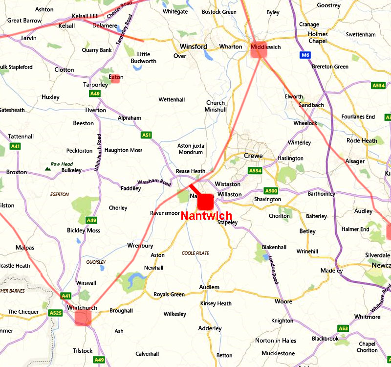
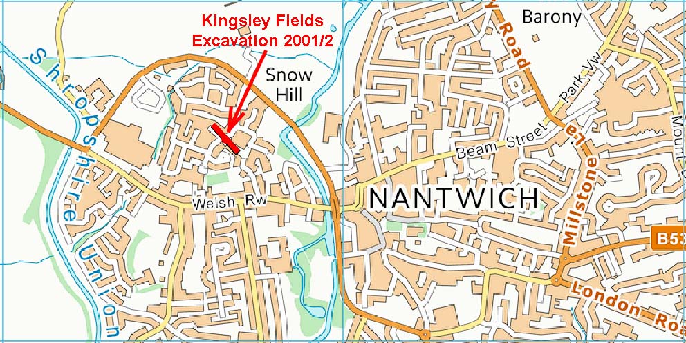
The Nantwich Roman (Link) RoadMargary Number: 700aaDistance: 1.25 milesNantwich was an important Roman salt production site and must therefore have had good road connections. In 2001/2 excavations prior to housing development at Kingsley Fields by Arrowsmith & Power (Roman Nantwich: A Salt-Making Settlement (Monograph), 2012. SCH7339) found salt production tanks and a Roman road. The latter was heading north-west towards the main Middlewich to Whitchurch Roman road. For details of the excavation follow CCC HER link |
Historic Counties: Cheshire Current Counties: Cheshire HER: Cheshire
|
|
|
|
|
|
Kingsley Fields Excavation Site The direction of the road found by Arrowsmith & Power made tracking down the Nantwich link road straight forward. |
Click for larger view |
 |
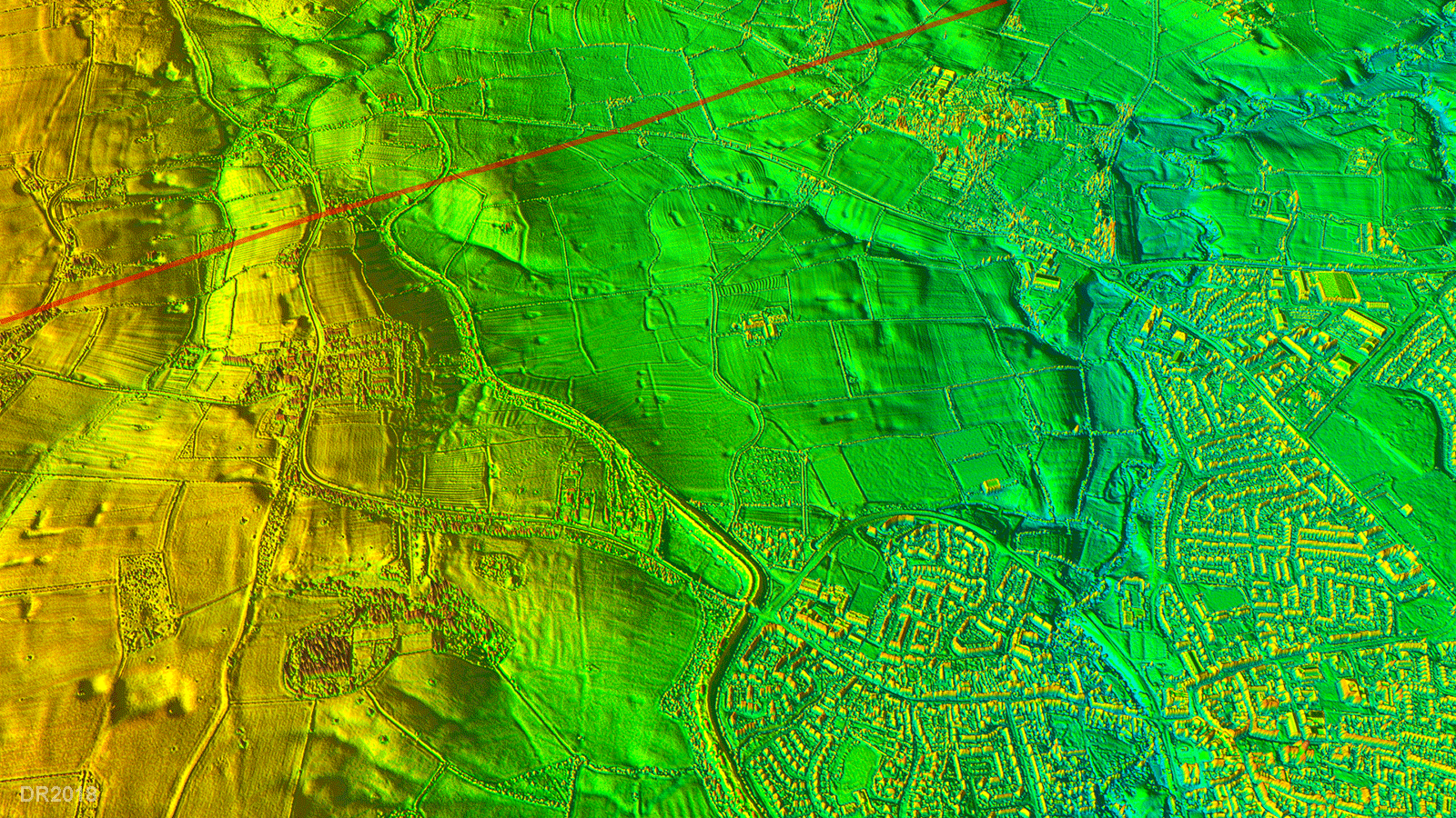
Lidar Image & Route Map The main Middlewich to Whitchurch Roman road lay only just over a mile from Nantwich so all that was required was a short link road. The Lidar evidence would indicate perhaps the road was not constructed to the highest military standards as it has not survived as well as the main road to Whitchurch. However, enough traces seem to have survived to indicate its course.. |
Click for larger view |
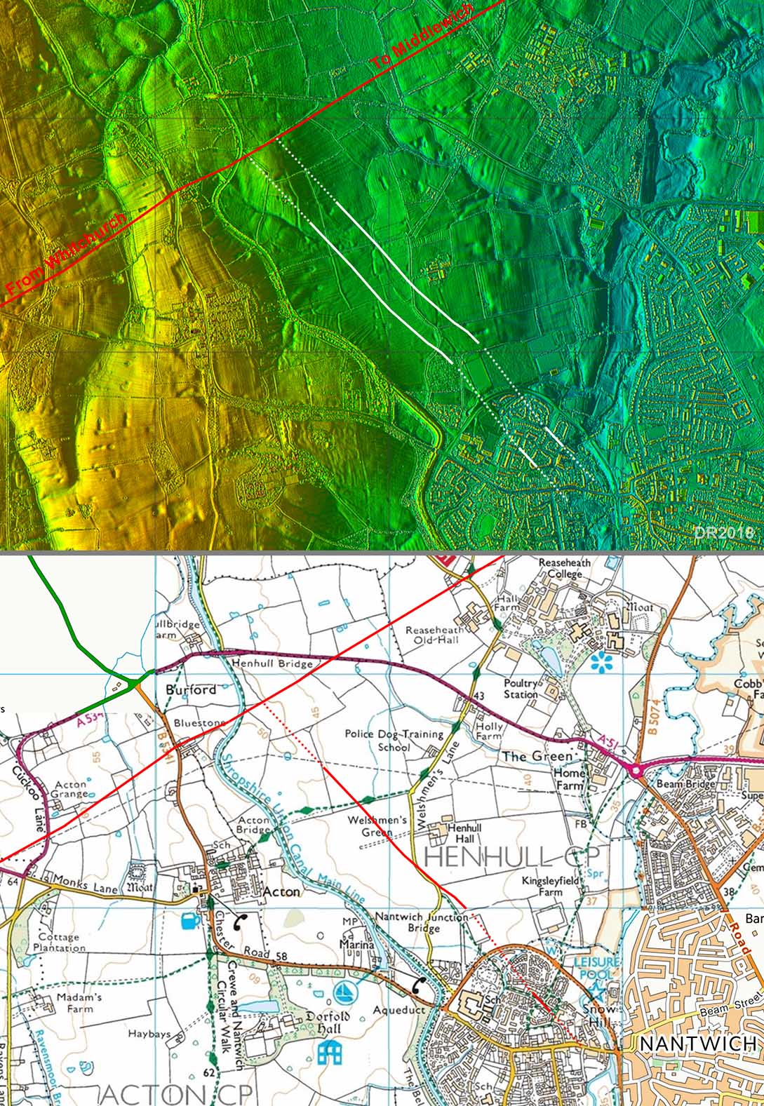 |
Oblique 3D Lidar Image This oblique lidar view shows the course of the Link road very well. |
Click for larger view |
 |
Possible Route via Welshmen's Lane By constructing a single link road then there would always be scope for a (later) short cut. There is some Lidar evidence that a route via Welshmen's Lane could have been just such a short cut for Middlewich traffic. There is lidar evidence alongside the lane in two lengths. |
Click for larger view |
 |
|
|
|
Last update: August 2018 |
© David Ratledge |