|
The Roman Road from Chester to Aldford (East bank of River Dee)Margary Number: 6aaDistance: 5.5 milesWatkin in Roman Cheshire (1886, page 55) quotes a Dr. Foote Gower proposing a road on the east bank of the River Dee going via Boughton and Huntington to Aldford. He quotes no finds or proof for it just that the modern road "covers it". A road down the east bank of the River Dee does make a lot of sense and was really to be expected. Lidar has now produced some evidence for the road in the Huntington area. North of there to Boughton then it is covered in modern development so a line here is somewhat based on extrapolation. South from Huntington to Alford then the modern road has straight sections and probably represents the route much as Dr. Foote Gower thought. Lidar has also revealed what appears to be a previously unknown Roman fort alongside the road.
|
Historic Counties: Cheshire Current Counties: Cheshire HER: Cheshire
|
|
|
|
|
|
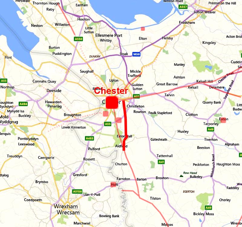
Route Map 1 - Chester to Huntington Quite where the road for Aldford branched of the Northwich road was not recorded by Watkin. However, English Heritage records a cremation site here and as cemeteries were located alongside roads then the course shown could be close to the truth. The first Lidar evidence does not occur until south of the suburbs at Huntington. |
Click for larger view |
 |
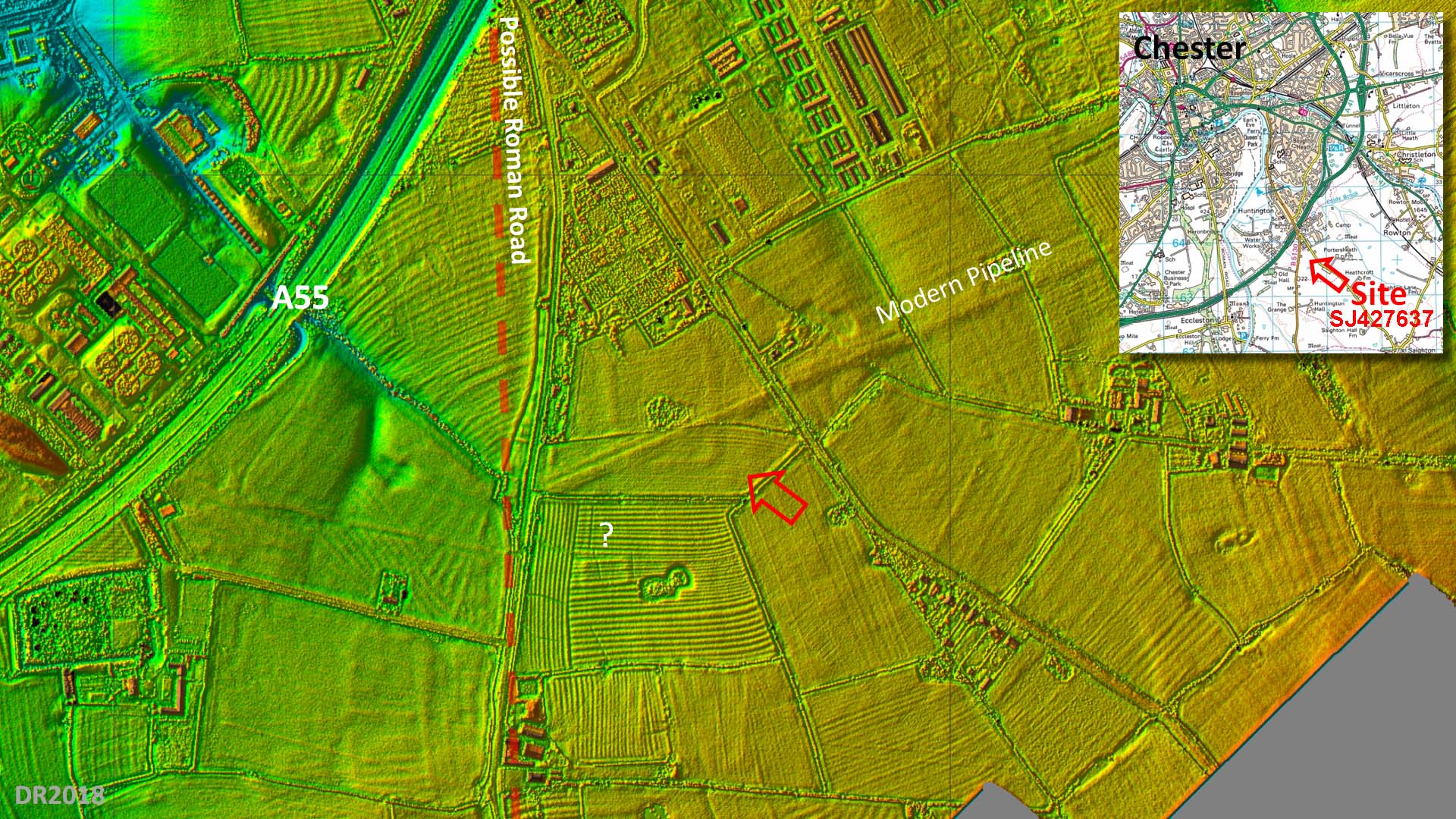
Oblique 3D Lidar Image - Possible Fort site Whilst tracing this road, a possible fort site was spotted by one of the authors (Ratledge) just east of the road alignment. This has been reported and is now included in the Cheshire HER. It was previously unknown despite a pipeline having been constructed right through it in the 1970s.
|
Click for larger view |
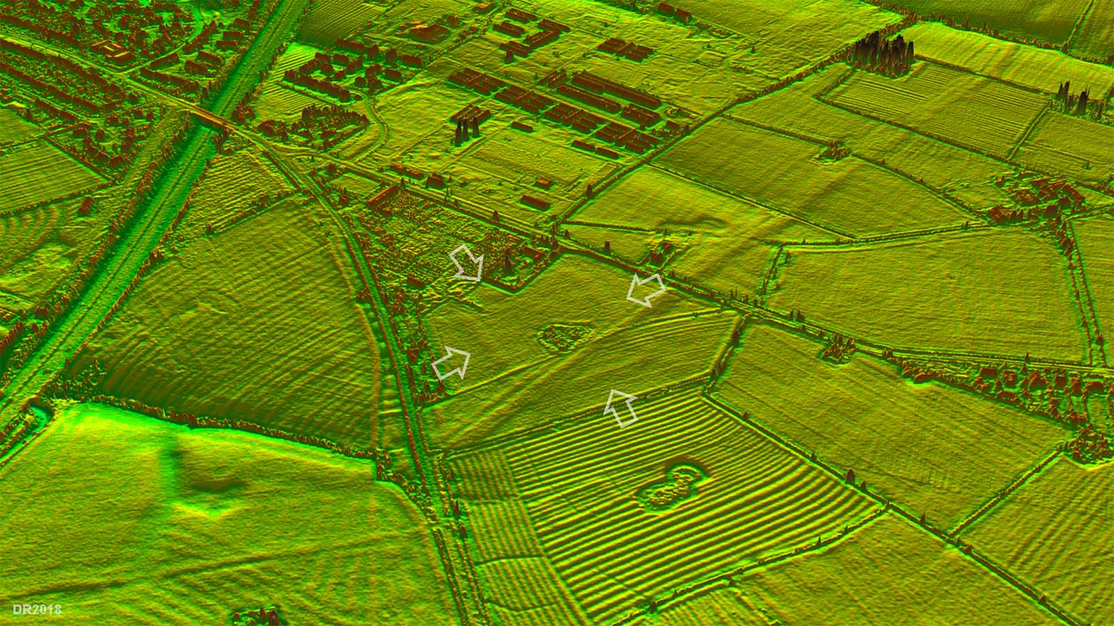 |
Lidar Image of Possible Fort site The orientation of the fort respects the Roman road and its features are more akin to a fort than a temporary camp. The modern pipeline is very prominent. Just north of the "fort" is the Roman settlement of Saighton Camp. The close proximity of both cannot be a coincidence and it is likely the two sites were related. |
Click for larger view |
 |
Lidar Image - Huntington Detailed lidar image of the traces of the Roman agger where the modern road drifts off line at Huntington.
|
Click for larger view
|
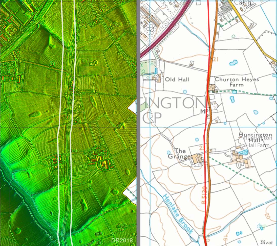 |
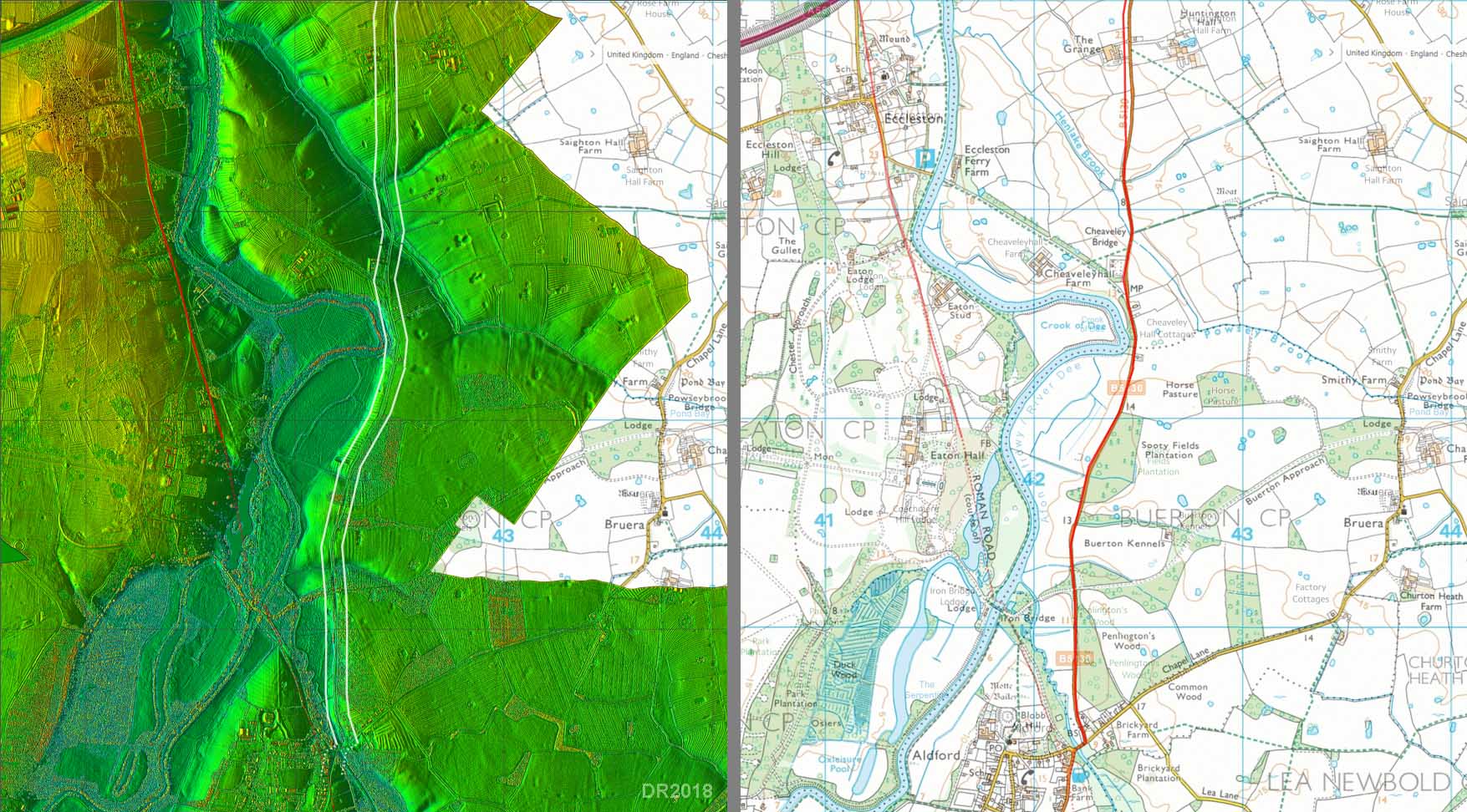
Route Map 2 - Huntington to Aldford The modern road is fairly direct with straight sections and probably therefore overlies the Roman line. Although the name Aldford records obviously a ford, in Roman times it would be assumed there was a bridge over Aldford Brook, possibly at or near the current bridge site. It would then join the main Roman road to Whitchurch. |
Click for larger view |
 |
|
|
|
Last update: July 2018 |
© David Ratledge |