|
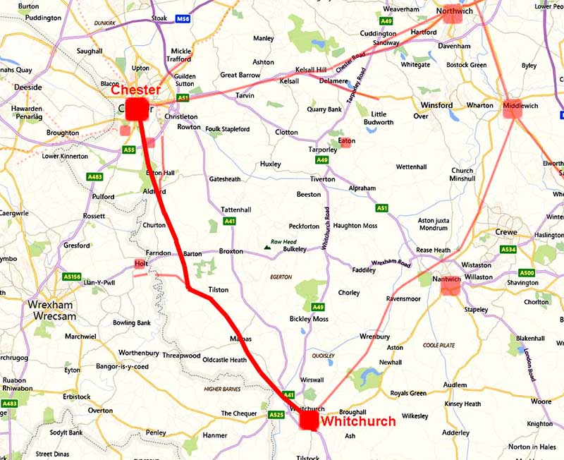
The Roman Road from Chester to WhitchurchMargary Number: 6aDistance: 20 milesAnother Roman road commonly referred to as Watling Street. It was the final part of a strategic highway for the Romans - Wroxeter to Chester and Antonine Iter II follows the route. This Iter includes a site called Bovium 10 miles from Deva (Chester). which would indicate a site at or near Tilston - see later. The route was largely known apart from the middle sector. Lidar has provided some clues as to this missing piece although it must be admitted it is still perhaps not totally certain.
|
Historic Counties: Cheshire & Shropshire Current Counties: Cheshire & Shropshire HER: Cheshire & Shropshire
|
|
|
|
|
|
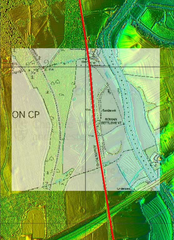
Route Map 1 - Chester to Eaton Hall A very secure first section with the course of the road not in dispute. It passes the Roman site of Heronbridge around 2 kilometres from Chester - see later. |
Click for larger view |
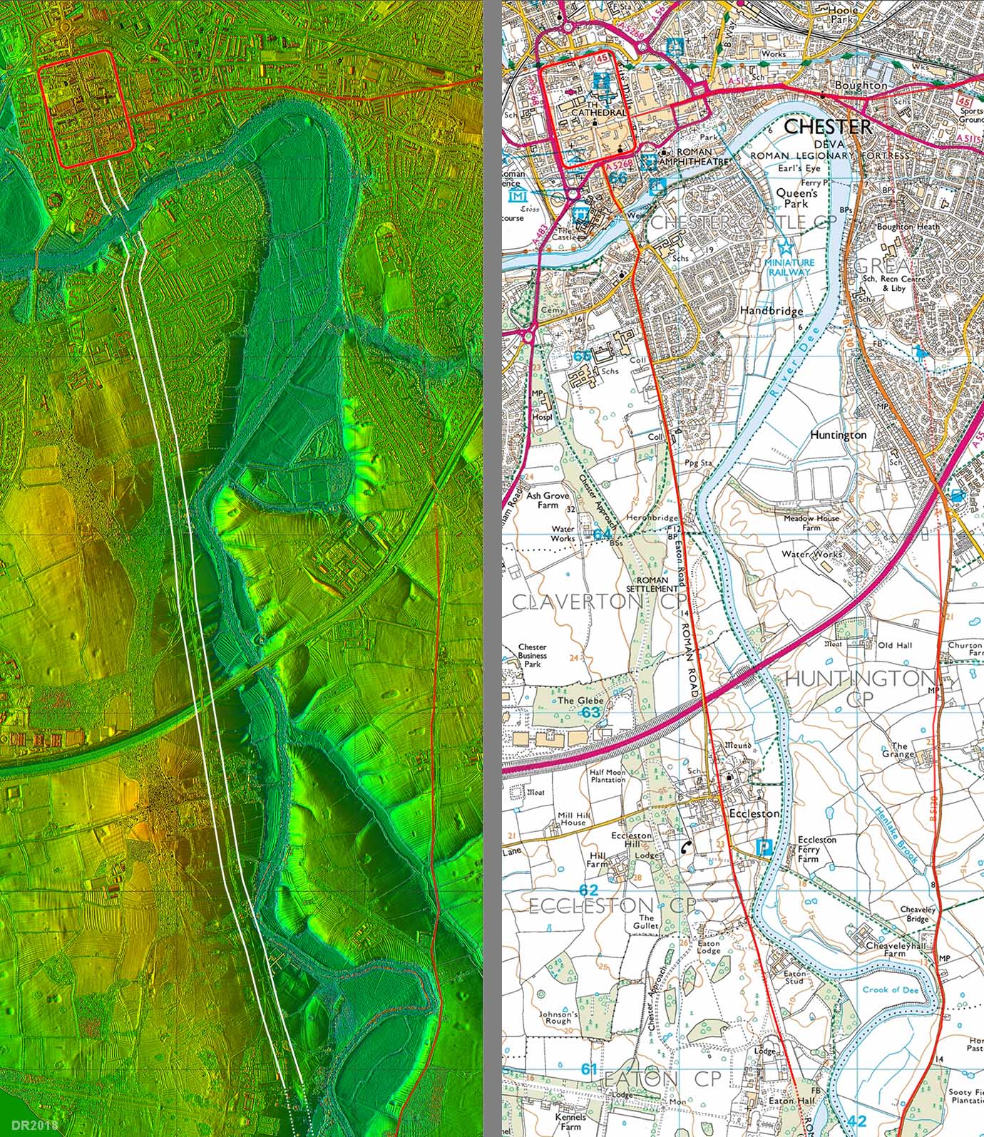 |
Oblique Views from Chester South Gateway - Lidar and Google The road leaves the south gate of the fortress and must have crossed the River Dee on a bridge on or very close to the modern one. Strickland (JCAS 1984, p25) includes a photo of old bridge debris just downstream of the current bridge. One would expect the debris of an early bridge to have fallen downstream but Strickland also mentions traces of old piers (but no photo) so perhaps slightly downstream of the modern bridge is the best we can estimate. Our map above has the line half on/half off the modern bridge on its downstream side! The current Eaton Road follows the Roman line for much of its course via Eccleston to Eaton Hall.
|
Click for larger view
|
 |
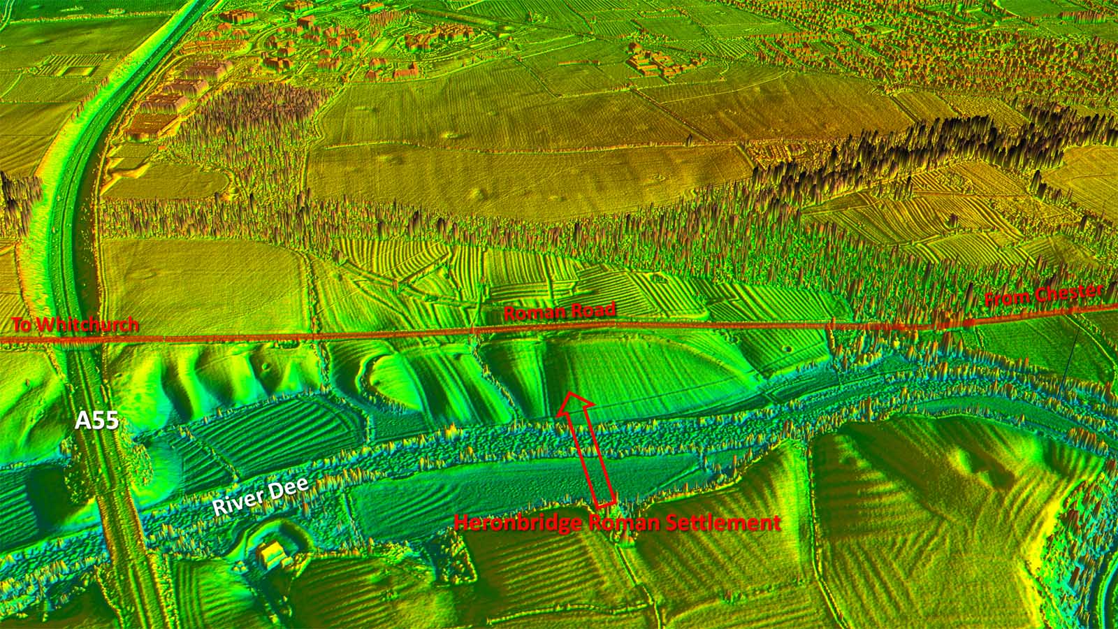
Heronbridge Roman Settlement - Lidar with Map The Roman site at Heronbridge, between the Roman road and the river, was discovered in 1929. It has a very complex history and what is visible today, i.e. the crescent shaped earthen bank, is almost certainly post-Roman. It is most likely related to the Battle of Chester (c. 613AD). Roman material seems to have been re-used in building the rampart/bank. |
Click for larger view |
 |
Oblique Lidar Image - Heronbridge Excavations took place in 1930–1 and found human remains with evidence of violent deaths. Further investigations took place in 2003–04, and the site was also a target of the archaeological television programme Time Team in 2005. In the 2010s about a dozen skeletons from the 1930-31 excavation were re-identified in the collections of the Manchester Museum, the majority exhibiting severe trauma injuries. Carbon-dating of two further skeletons, uncovered in 2004, is consistent with a date of death in the early 7th century. (Information from Wiki) For more details of this site see follow this link - Heronbridge |
 |
|
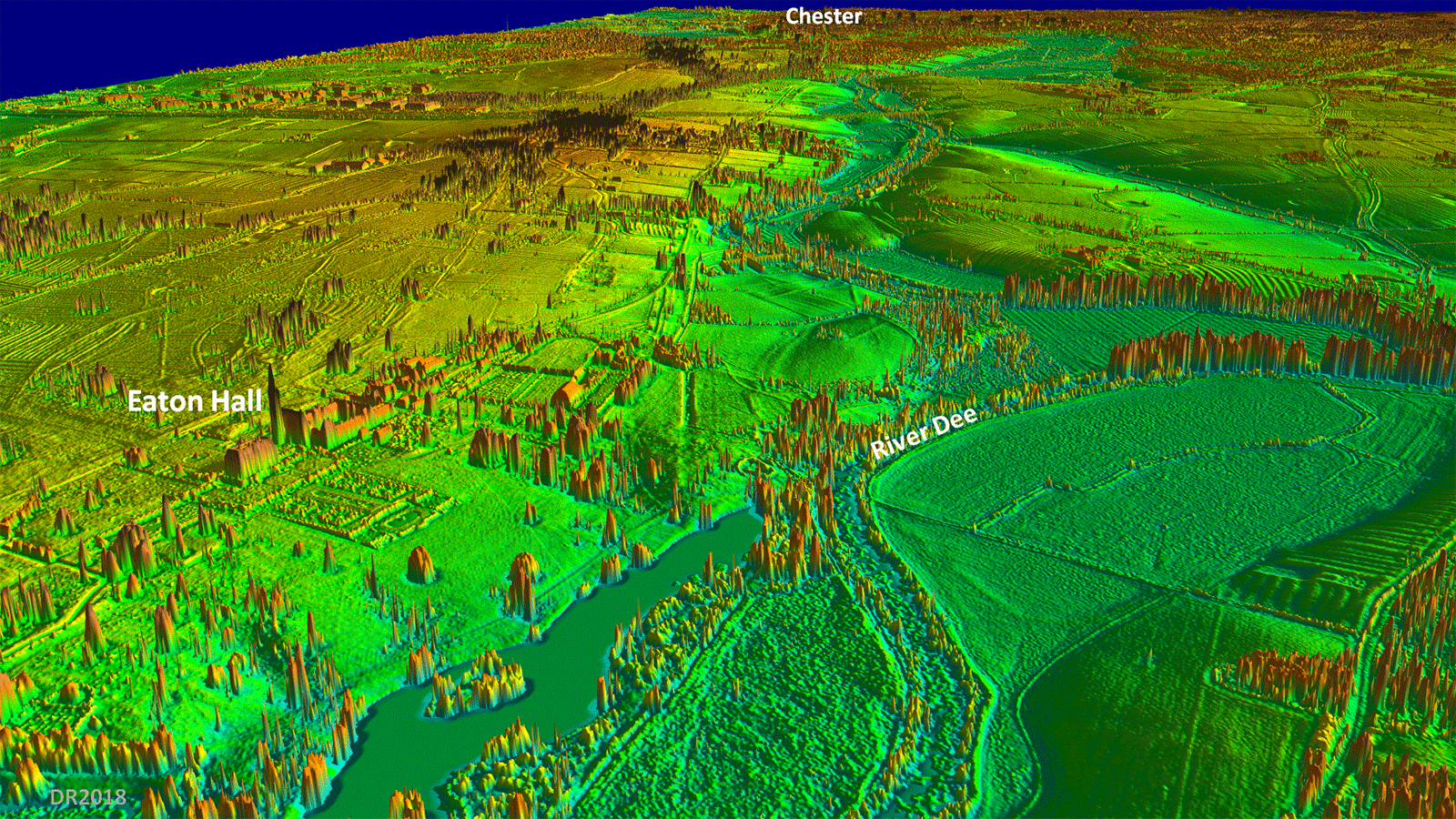
Oblique Lidar Image - Looking back to Chester from Eaton Hall At Eaton Hall the Roman road diverges from Eaton Road and crosses the grounds of Eaton Hall heading for a River Crossing. The very prominent straight cutting is not the roman line but is east of it. |
Click for larger view |
 |
Iron Bridge, 1824 Located just upstream of the Aldford ford was the probable Roman road crossing point - almost certainly a bridge. Iron Bridge is a Thomas Telford design in cast iron and comprises a 46 metre span. |
Click for larger view |
 |
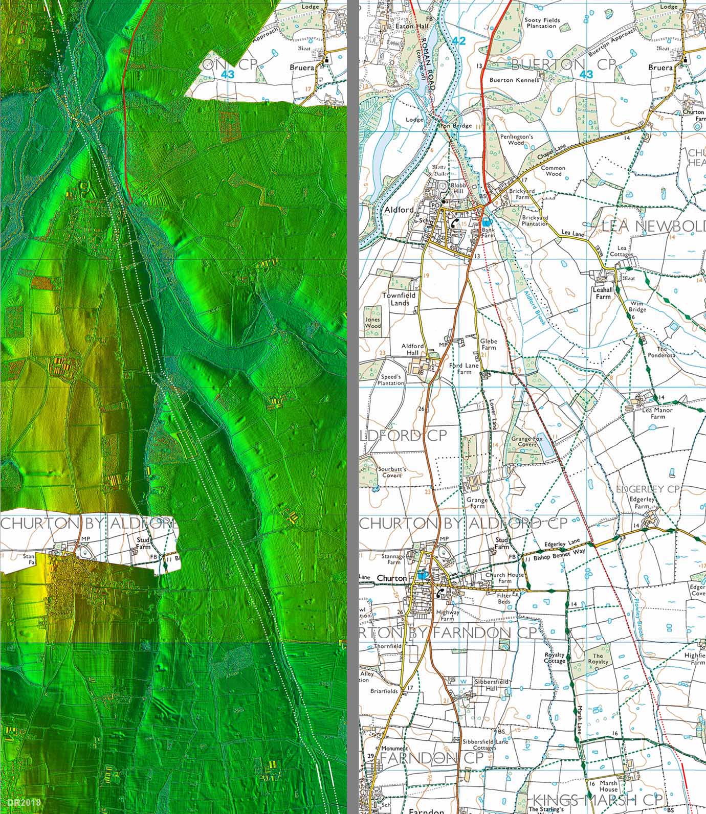
Route map 2 - Eaton Hall to Kings Marsh Although the crossing of the River Dee is believed to alongside the present iron bridge the actual course of the road across the flood plain is unknown. The route passes Aldford Motte & Bailey on its east side and is well recorded as far as King's Marsh where it course becomes problematical. The route shown on the map (right) is our suggestion based on (fragmentary) Lidar evidence and the premise that the alignment from Aldford continued more or less straight on. |
Click for larger view |
 |
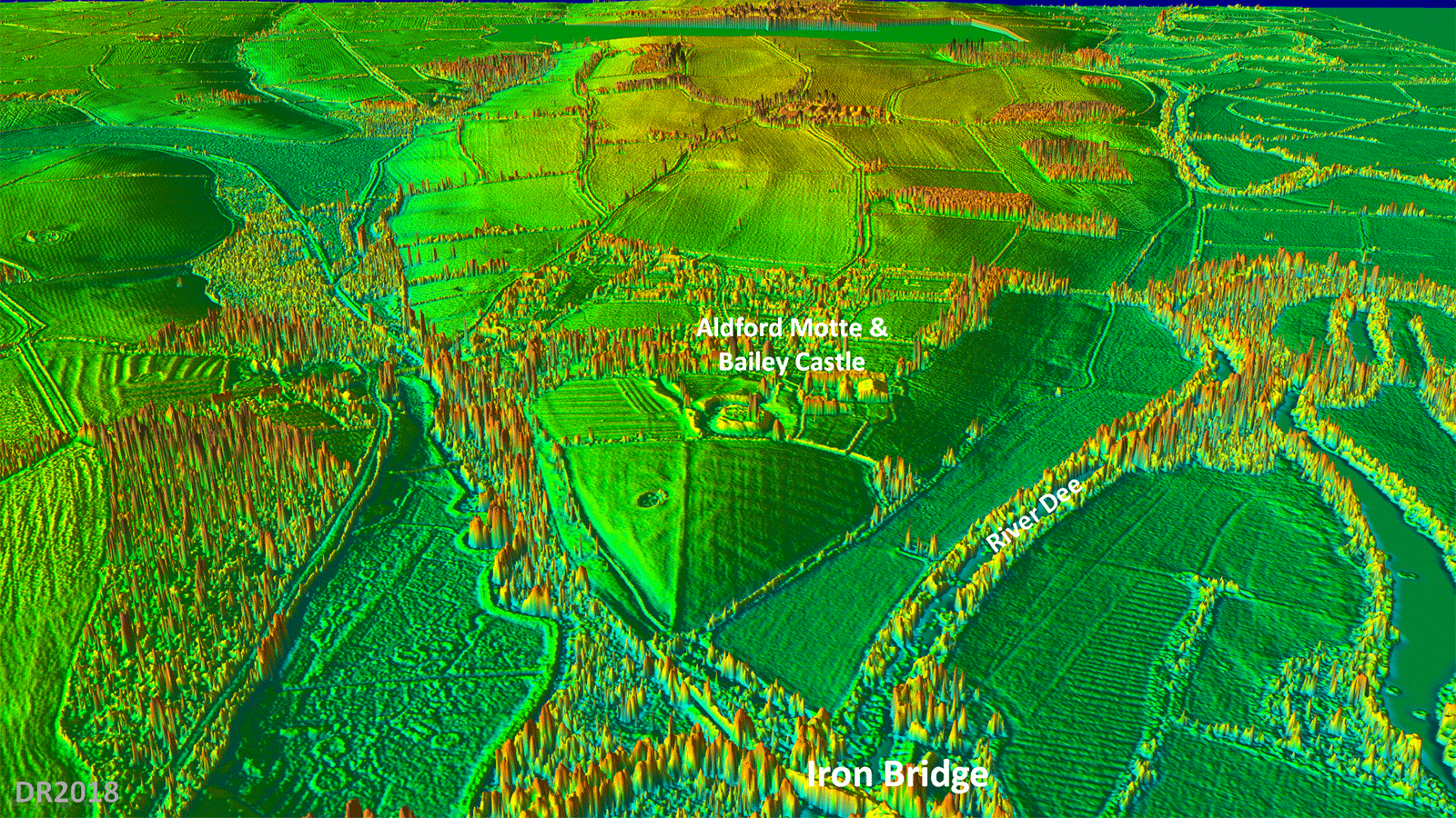
Oblique Lidar Image - Aldford There is what looks like a straight agger heading up to the Motte & Bailey castle but the Roman line is much more likely to have kept straight and skirted around the side of the hill. |
Click for larger view |
 |
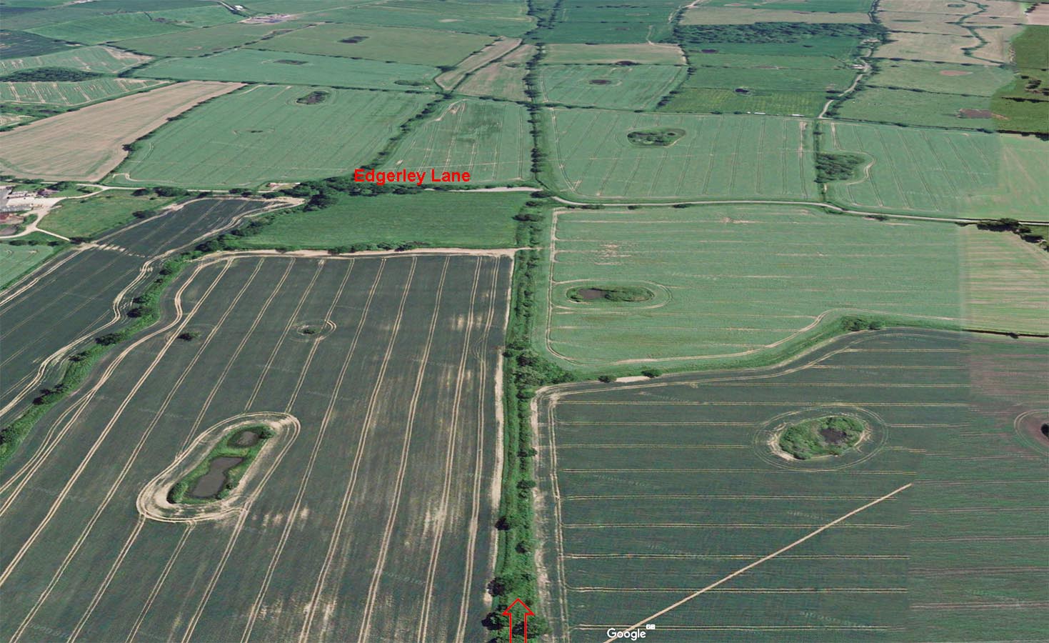
Oblique Google Earth View - crossing Edgerley Road A fabulous stretch of surviving Roman road agger to the east of Churton crossing Edgerley Road. Unfortunately this is not a public right of way. M. St. J. Way (Journal Chester AS, 1961) carried out 2 excavations of the road north of Edgerley Road. His assumed projection from this point taking the road under Stretton Hall turned out to be incorrect. |
Click for larger view |
 |
Route Map 3 - Kings Marsh to Tilston The route of the road from Kings Marsh across Barton Road is perhaps the least secure on the whole length. There are some faint Lidar indications that it passed east of the garage on Barton Road and on balance this seems the most logical course. It has long been believed the Roman road went under Stretton Hall but Lidar indications are that the route is around 0.5 miles west of this. Beyond Tilston then Malpas Road/Wet Lane marks the roads course for the next few miles For a more detailed and enlarged image of the Wetreins road junction see below. |
Click for larger view |
 |
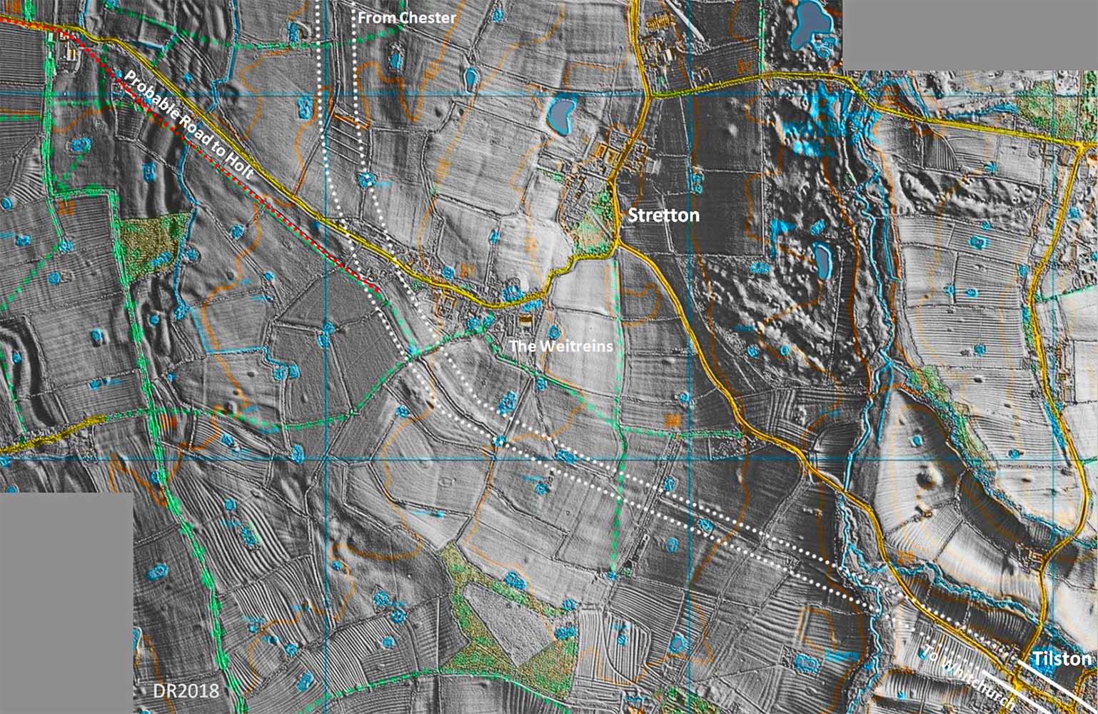
The Wetreins, Stretton - Lidar Image and probable Road junction In this more detailed Lidar image of the Wetreins road junction then the arrangement of the roads becomes clearer.The Cheshire HER remarks that the Chester road could be a branch off the Holt Road. However, this image would indicate probably the opposite - the Holt road looking more likely a branch off the Chester road, which therefore would be the earlier. This in reality was to be expected. |
Click for larger view |
 |
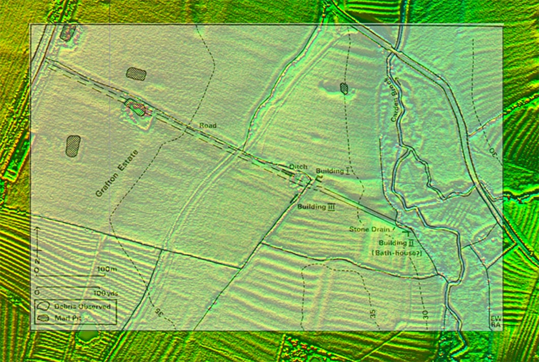
Possible Site for Bovio/Bovium - Site Plan Just north of Tilston is this possible site for the missing Roman site of Bovium. It lies at the requisite 10 miles from Chester and was discovered by E & A Waddlelove (ref 1). Their map is overlaid on a Lidar image (right) and locates the buildings they discovered alongside the road. Plan courtesy of Adrian Waddelove. Note this is private land with no public access. Ref 1: Waddelove, A.C.; Waddelove, E. (1984). "The Location of Bovium". Britannia 15, Society for the Promotion of Roman Studies. pp. 255–257. Note: Colin Smith and ALF Rivet in "The Place-Names of Roman Britain" (1979, p274) give "Bovium" as the correct form although "Bovio" is how it appears in the Antonine Itinerary. Thanks are due to Adrian Waddelove for reading through this page and making several suggestions - now included. |
Click for larger view |
 |
Possible Site for Bovio/Bovium - Oblique 3D Lidar View The road is very clear climbing up from the stream in a slightly curving cutting. The Roman site is less clear but what is apparent is the extensive ploughing in the area. If this is the site of Bovium then not much would have appeared to have survived and scattered finds now is perhaps the best that could be hoped for. |
Click for larger view |
 |
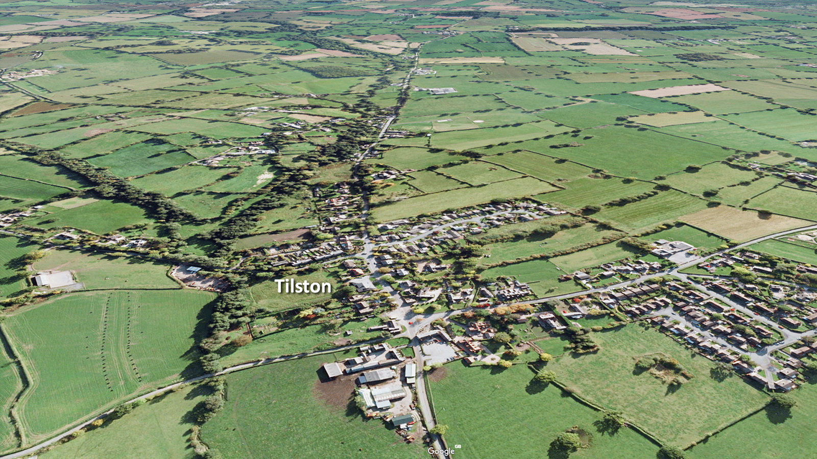
Oblique Google Earth View - Tilston The route of Margary 6a is straight through Tilston although probably a little straighter than the modern road which wiggles around a bit today. This is typical of Roman roads and is usually due to encroachment over the centuries. |
Click for larger view |
 |
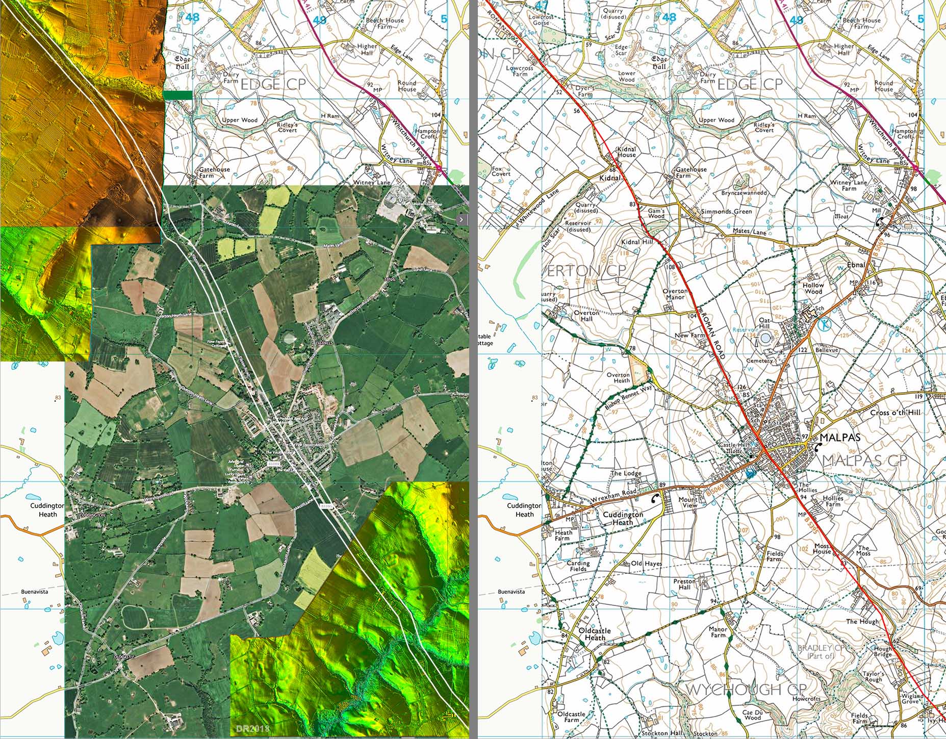
Route Map 4 - Tilston to Wigland Grove via Malpas The route is much more definite over this stretch. Although there is currently a gap in the Lidar coverage this is not an issue as the road can be followed pretty clearly on the aerial photograph. |
Click for larger view |
 |
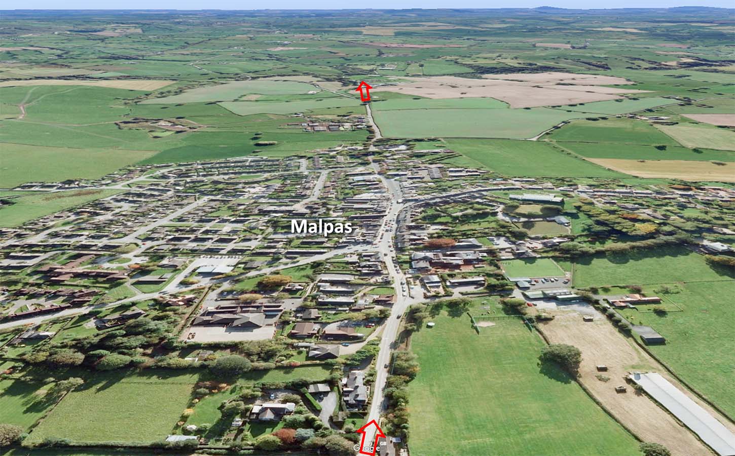
Oblique Google Earth View - Malpas The Roman road passes through the centre of Malpas. However, it doesn't appear to have been a Roman site. The famous Malpas Diploma actually was found 3 miles away. |
Click for larger view |
 |
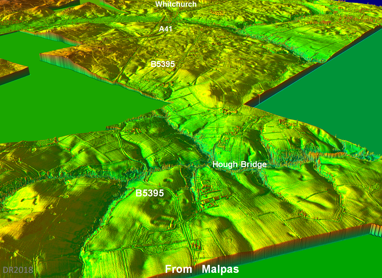
Oblique Lidar Image - Hough Bridge to Whitchurch The Romans took a pretty direct route to Whitchurch whereas the B5395 takes a circuitous route but with less climbing. The modern Hough Bridge and the Roman one probably coincide.. |
Click for larger view |
 |
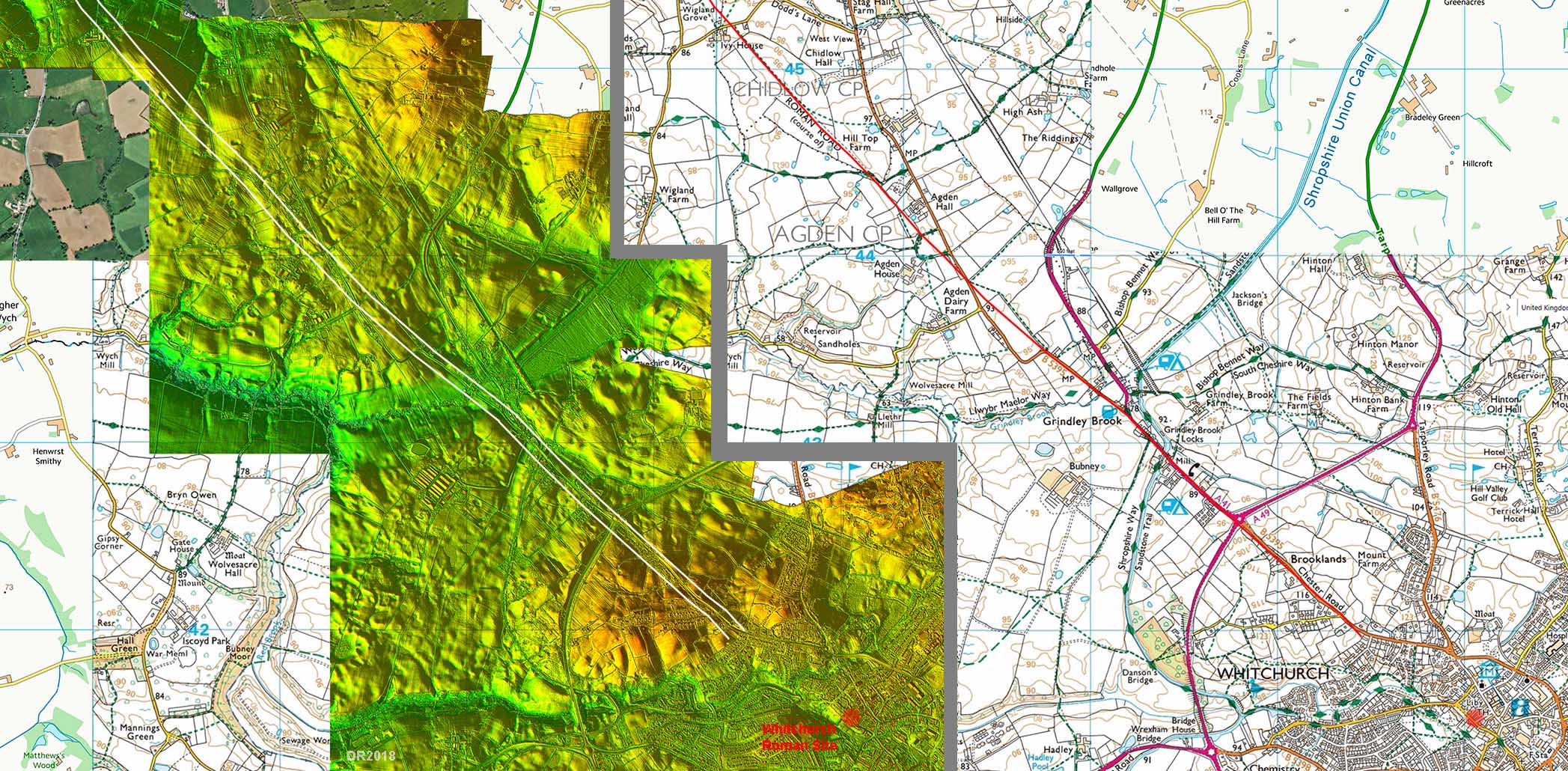
Route Map 5 - Wigland Grove to Whitchurch The Roman road rejoins the B5395 just north of Grindley Brook for the final run into Whitchurch The Roman site at Whitchurch is not precisely defined so we have shown its approximate position - marked with a red circle. |
Click for larger view |
 |
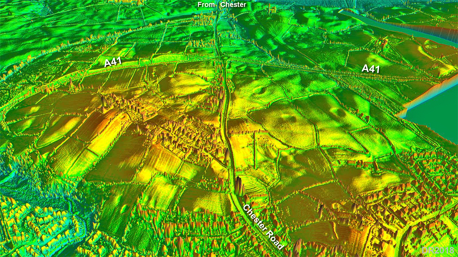
3D Oblique Lidar Image - Whitchurch looking North The Roman road into Whitchurch itself most likely follows Chester Road but where the latter deviates off to the east the Roman line probably carried straight on. |
Click for larger view |
 |
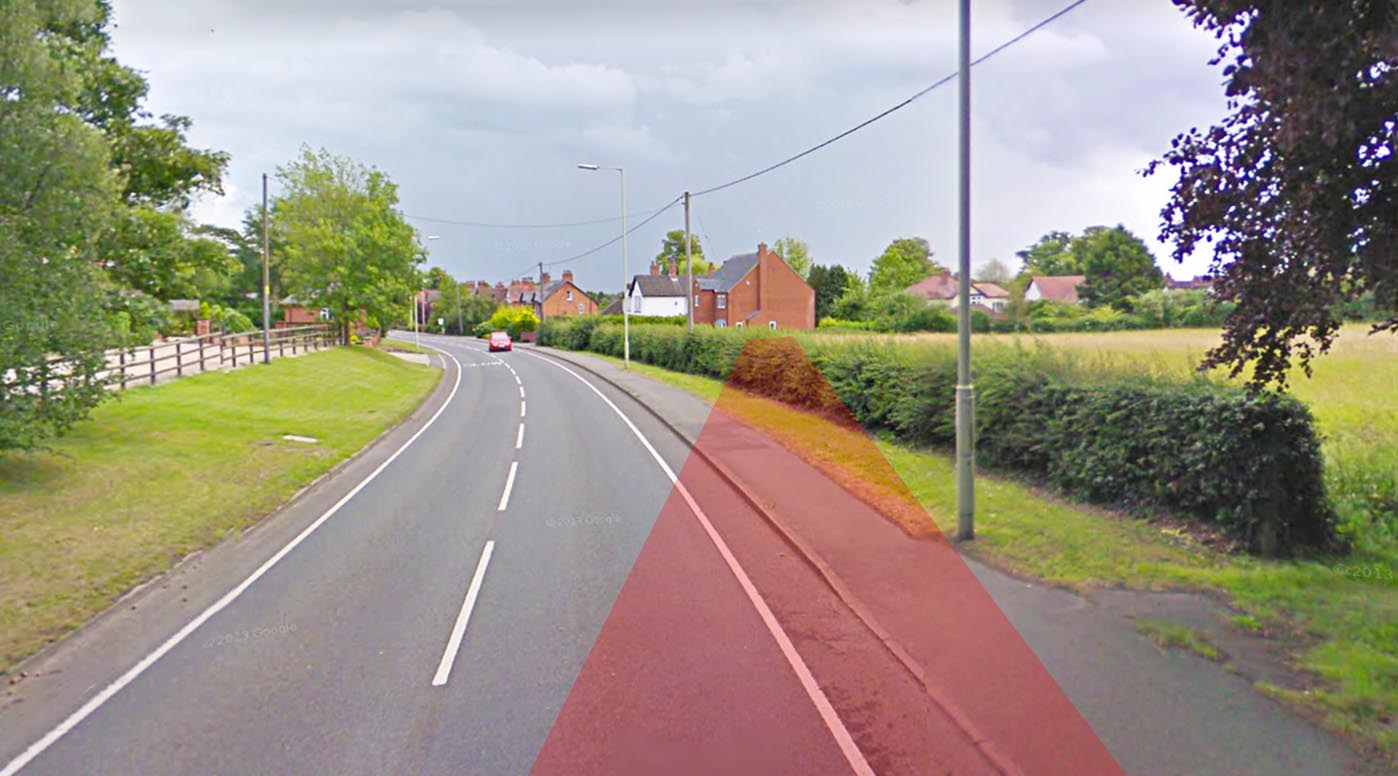
Chester Road approaching Whitchurch This is where Chester Road swings off line to the east but the Roman road probably carried straight on. Lidar shows a probable agger in the field over the hedge heading for the first house. |
Click for larger view |
 |
|
|
|
Last update: August 2018 |
© David Ratledge |