|
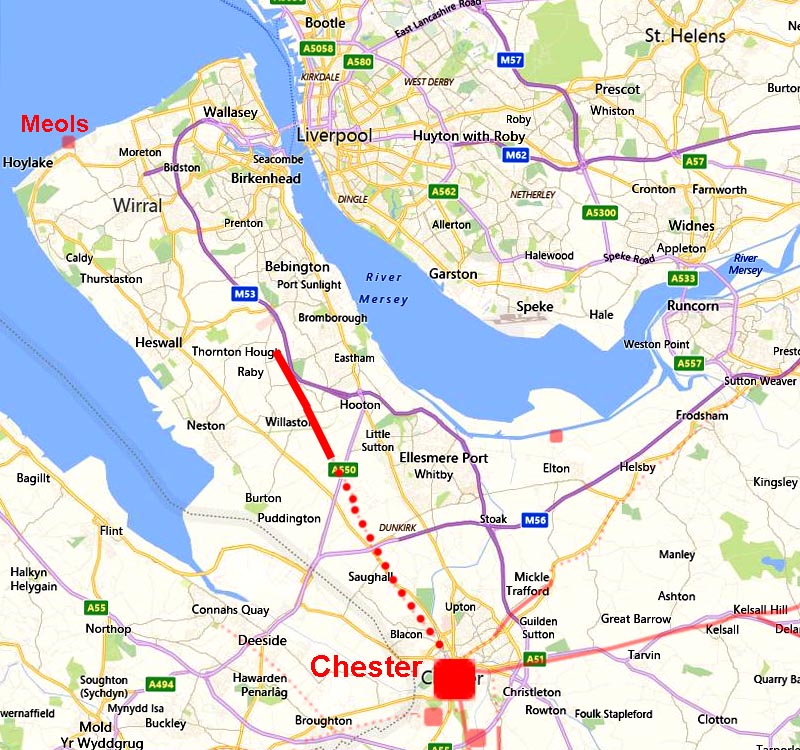
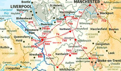
The Roman Road from Chester to the WirralMargary Number: 670Distance: 15 miles (assuming Birkenhead as its destination)Included for completeness but is this really a Roman road? It all comes down to less than 3 km of possible road at Street Hey, near Willaston. That name of course is a big clue and Jermy in the 1960s excavated the road there and was convinced he had found and proved a Roman road (see reference below). The problems are all away from Street Hey. No one has found a convincing route back to Chester and even Lidar has not really helped. In the other direction it is a similar story with suggested destinations of Meols and/or Birkenhead also producing no likely road. However, perhaps the strongest evidence that this really being a Roman road is the Gough Map - see later. This map, dated to 1360, shows a highway from Chester to Liverpool. Most of the roads on the Gough map are based on original Roman routes.
|
Historic Counties: Cheshire Current Counties: Cheshire HER: Cheshire
|
|
|
|
|
|
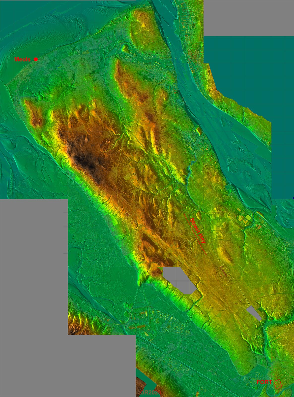
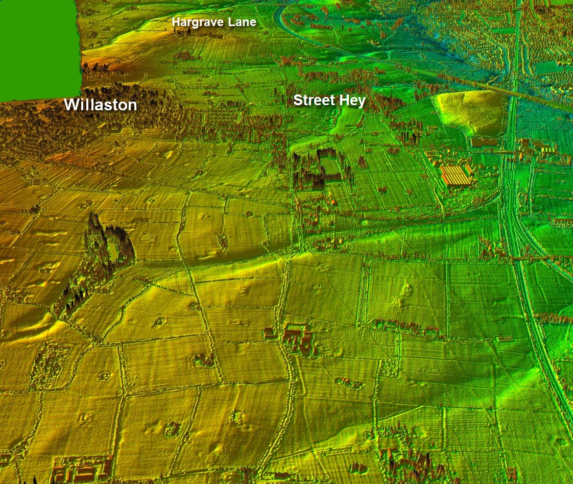
Lidar Image - The Wirral The Lidar equivalent of the map below. The Street Hey section is shown. If Street Hey is Roman it would make more sense as a road to the Birkenhead area. |
Click for larger view |
 |
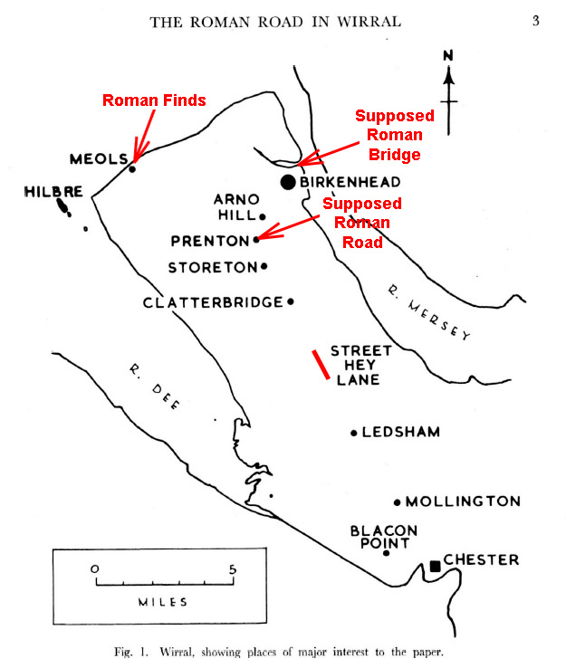
Route Map 1 - Chester to Huntington Jermy was the biggest protagonist for this road and his findings are recorded in Journal of the Chester Archaeological Society 1961 & 1963. His location map is shown right with other previously suggested clues as to where the rood was heading added in red. Taking them in distance order:- The so-called Roman Road at Prenton can safely be discarded - it has no Roman characteristics. Watkin (Roman Cheshire) records a very substantial bridge at Birkenhead. So massive and old that he concluded it must have been built by the Romans. If this were the road's destination a route via Storeton Hill and Mount Road would seem logical. There have been suggestions of an agger east of Hargrave Lane but not convincing ones in the Lidar data. Meols (pronounced Mells) - there can be no doubt this was a Roman site - there have been so many finds there. But again a connection back to Street Hey has not been forthcoming. For a route to Meols then the A540 looks more logical. |
Click for larger view |
 |
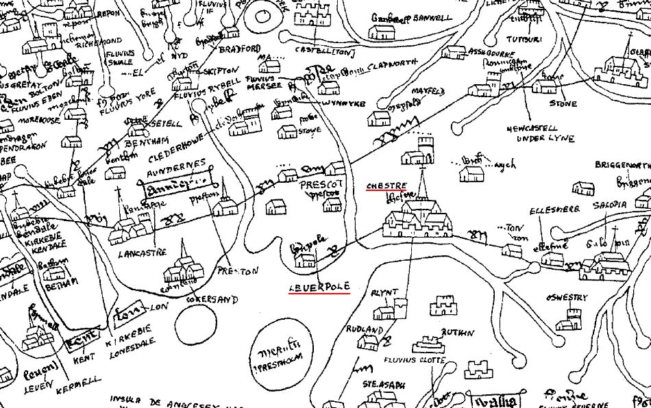
Gough Map c. 1360 - extract The so-called Gough Map is the earliest surviving map of Britain dating from c.1360. It’s origins are unknown and owes it name to, Richard Gough (1735-1809), in whose collection it was found. It is very crude and has north to its left. The majority of the roads shown are based on Roman roads, there was little alternative in 1360. It shows a highway direct from Chester to Liverpool. This would fit with this road (M670) heading for Birkenhead and a ferry to Liverpool. Surpisingly this evidence was not used by Jermy.
|
Click for larger view
|
 |
Oblique 3D Lidar Image - Street Hey This does look promising - well it is certainly straightish!
|
Click for larger view
|
 |
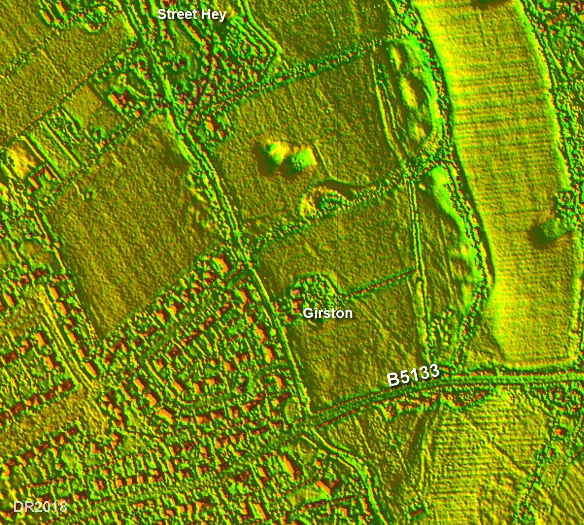
Jermy's Map & Lidar Image Jermy's two maps have been joined and overlaid on the Lidar image. Jermy cut two trenches and an off line control pit between the B5133 and the house "Girston". The results are given in his figures 6 & 7. What is shown is not a full cross section but what looks like pits. He found cobbles on sand. But he added "no agger in the construction of the road" was evident. Jermy was convinced he had proved a Roman road and in 1963 in a second paper added aerial photographs which he suggested supported what he had proposed. Having said that the aerials are not that convincing, at least to my eyes. On the basis of what he shows in his papers it is hard to be convinced. One can only assume he saw more than he reported.
|
Click for larger view |
 |
Lidar Image & Route Map - Street Hey Detail So what does Lidar show? Well there is something to the east of the hedge between Girston and the B5133 where Jermy excavated but is it a Roman road? On the basis of what is visible I am not sure we can say yes or no - a definite maybe. There is always the possibility the modern road here overlies the Roman line. |
Click for larger view |
 |
Lidar Image & Route Map - Street Hey full length This was the route as far as Jermy proposed and matches the scale of his map above.
|
Click for larger view |
 |
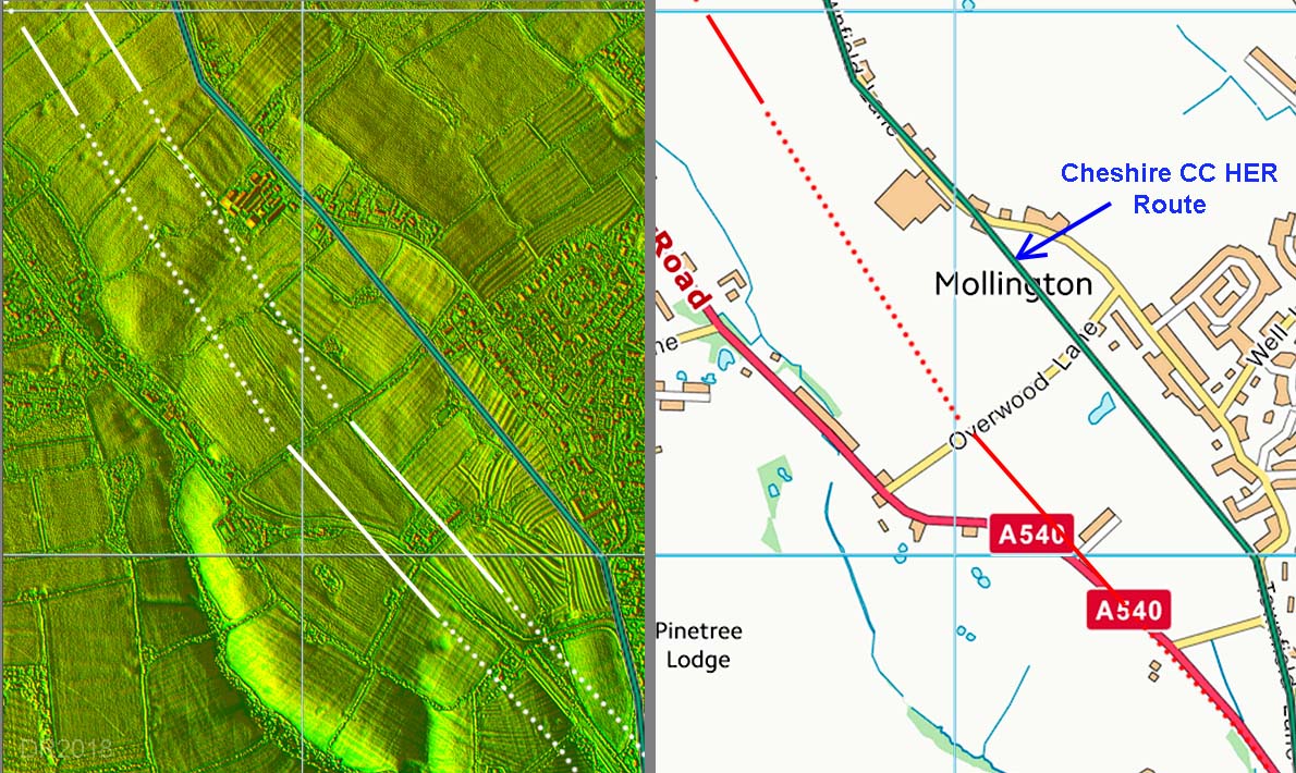
Lidar Image & Route Map - Mollington I attempted to find a route back to Chester from Jermy's stretch at Street Hey. There are features visible along a possible route with perhaps the most likely at Mollington. This is west of where Cheshire HER place the line of the road. I could could see nothing in the Lidar to support the HER route.
|
Click for larger view |
 |
Route Map & Lidar Image - Possible route to/from Chester Not a lot of other evidence so the route depicted is probably regarded as a good working hypothesis.
So is Margary 670 a definite Roman road? At the state of our current knowledge then it is perhaps best considered as "probable" with Birkenhead its most likely destination rather than Meols. |
Click for larger view |
 |
|
|
|
Last update: December 2018 |
© David Ratledge |