
|
The Cheshire North Ridge (Possible) Roman RoadMargary Number: 70aaDistance: 9? milesA very odd road that supposedly follows a ridge of high ground rather than having as its primary purpose of getting from A to B. Its existence is down to the work of one man, Ted Hughes of Lymm. Attention was drawn to it by Jermy (Britannia, 1990). Jermy reports it as being 14 to 18 metres wide with ditches - if true this is enormous. Several excavations have taken place and this width was confirmed. Two Sections between Appleton and Stretton are even scheduled as an ancient monument 1006770. Jermy's explanation for its odd course was that perhaps it was an early frontier - pre Agricola. However, as such should it not have had watch towers like the Gask Frontier in Scotland? 2021 Update:The release of series 2 lidar covering the suggested route for this road has cast serious doubt on its existence. I can see nothing that supports the Hughes/Jermy route. |
Historic Counties: Cheshire Current Counties: Cheshire HER: Cheshire
|
|
|
|
|
|
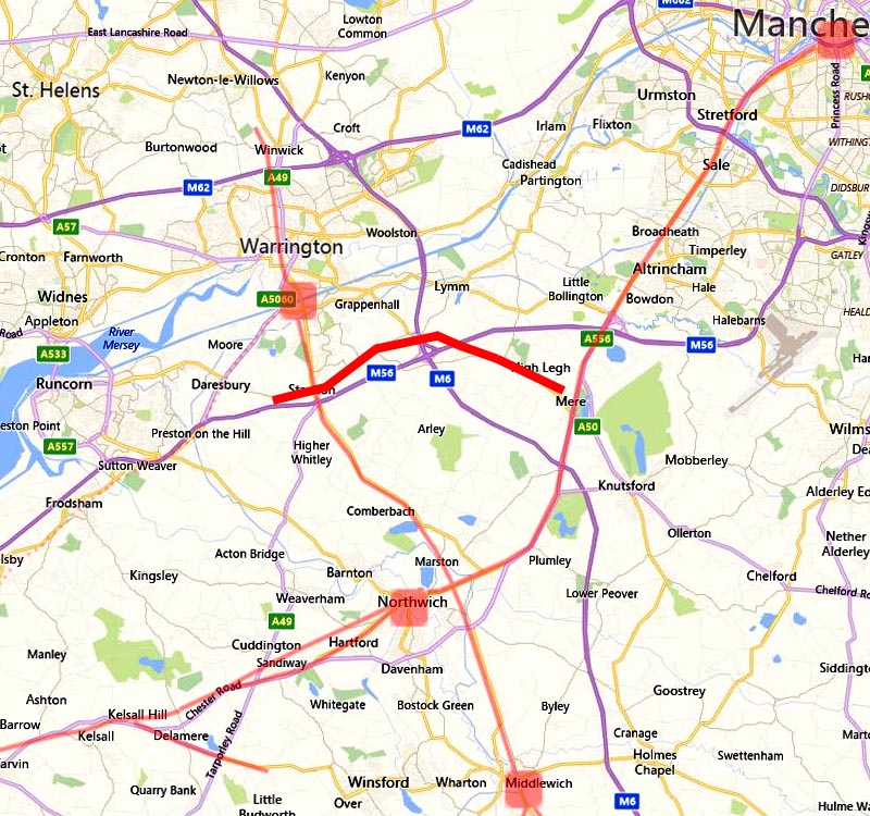
Full Route - Jermy's Figure 5 + Series 2 Lidar I have overlaid Jermy's figure 5 on top of the 2021 Lidar. To get a definitive line the Cheshire HER was also consulted and what is shown below is an amalgam of the two. Note The Cheshire HER shows the road going to Mere Crossroads but Jermy quite clearly indicates a straight-on route north of the mere. One cannot argue that there is definitely a ridge here but is there a Roman road?
|
Click for larger view |
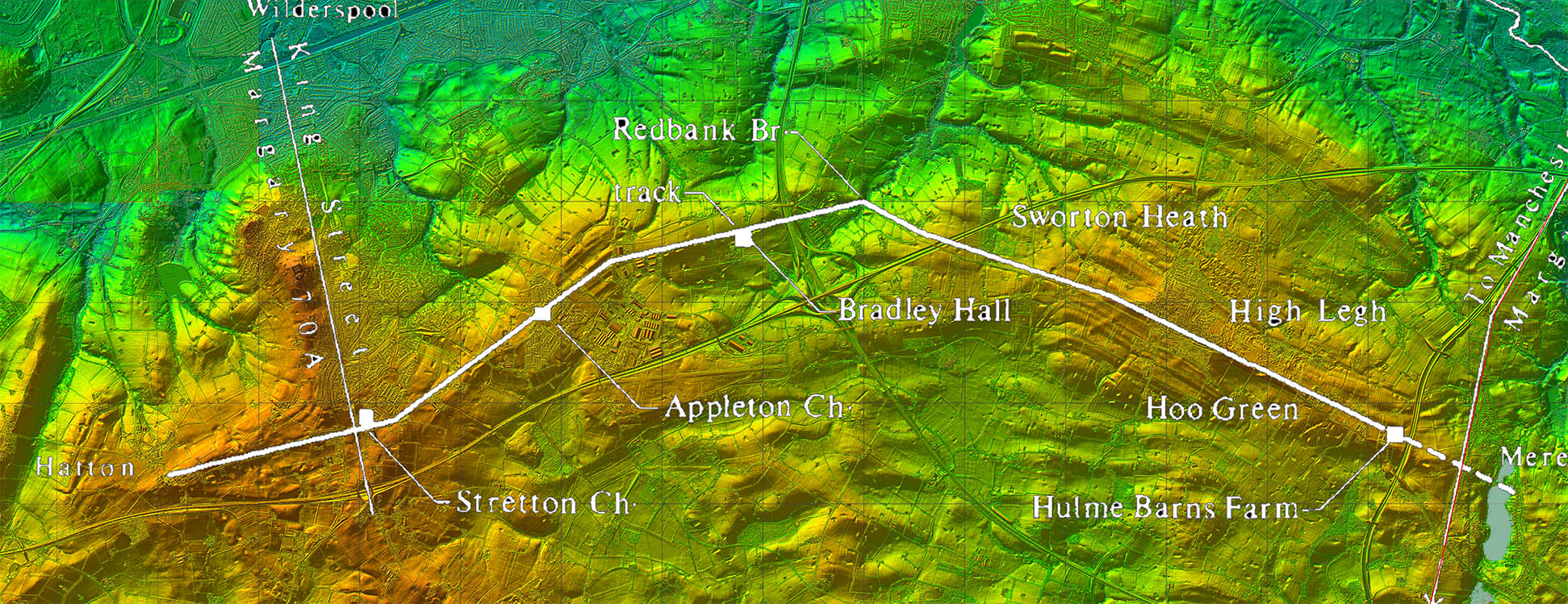 |
Route Map 1 - Hatton to Redbank Bridge Jermy plots the road generally to the north of Stretton Road and west of Appleton Thorn is where it was excavated. Despite this I cannot see anything that would convince me there was a Roman road here. |
Click for larger view |
 |
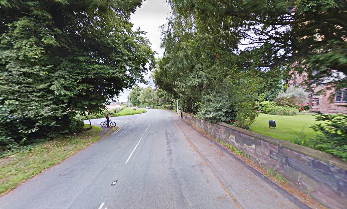
Stretton Church Jermy takes the road via Stretton Church - on the right of this image. We are looking west here towards Hatton. King Street passes right to left behind the cyclist. Jermy quoted the names Stretton and Pepper Street as supportive evidence. However, Stretton almost certainly would derive from King Street. Jermy's line doesn't actually align with Pepper Street or even pass through it. |
Click for larger view |
 |
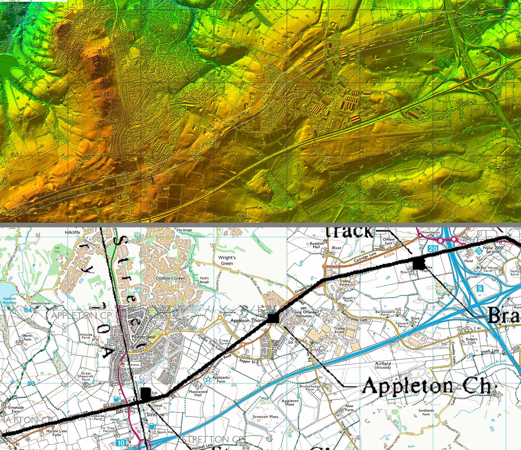
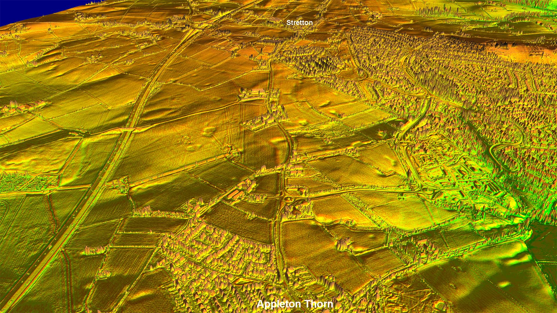
Oblique Lidar Image - Stretton to Appleton We are looking back from Appleton Thorn towards Stretton. The supposed routeshould be visible mainly to the right (north) of Stretton Road. Despite being recorded asup to 18 metres wide by Jermy nothing significant is visible.
|
Click for larger view |
 |
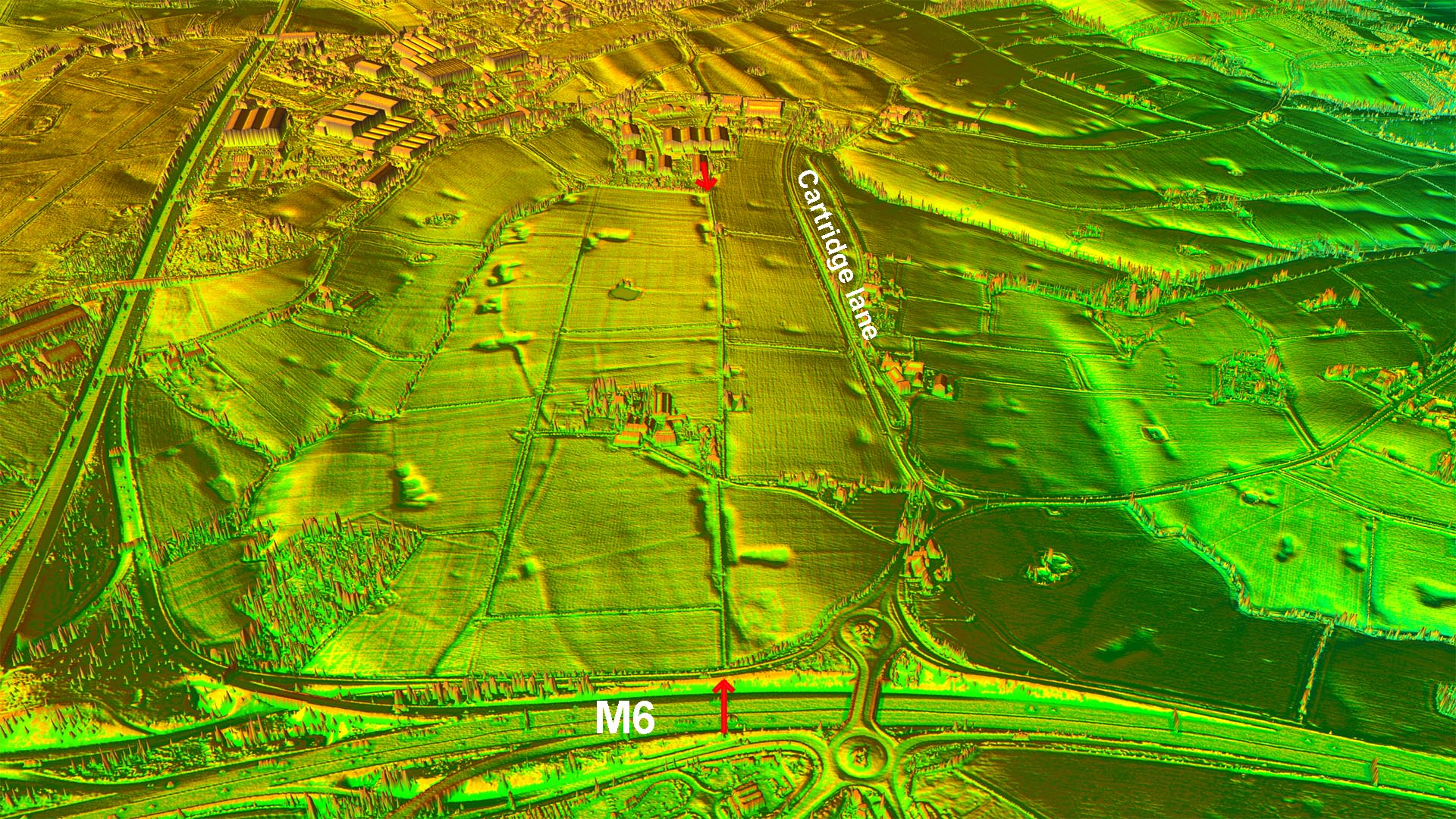
Oblique 3D Lidar Image - M6 looking West The hedgeline, marked with arrows, is supposedly the Roman road. Nothing looking like a possible agger appears to be visible.
|
Click for larger view |
 |
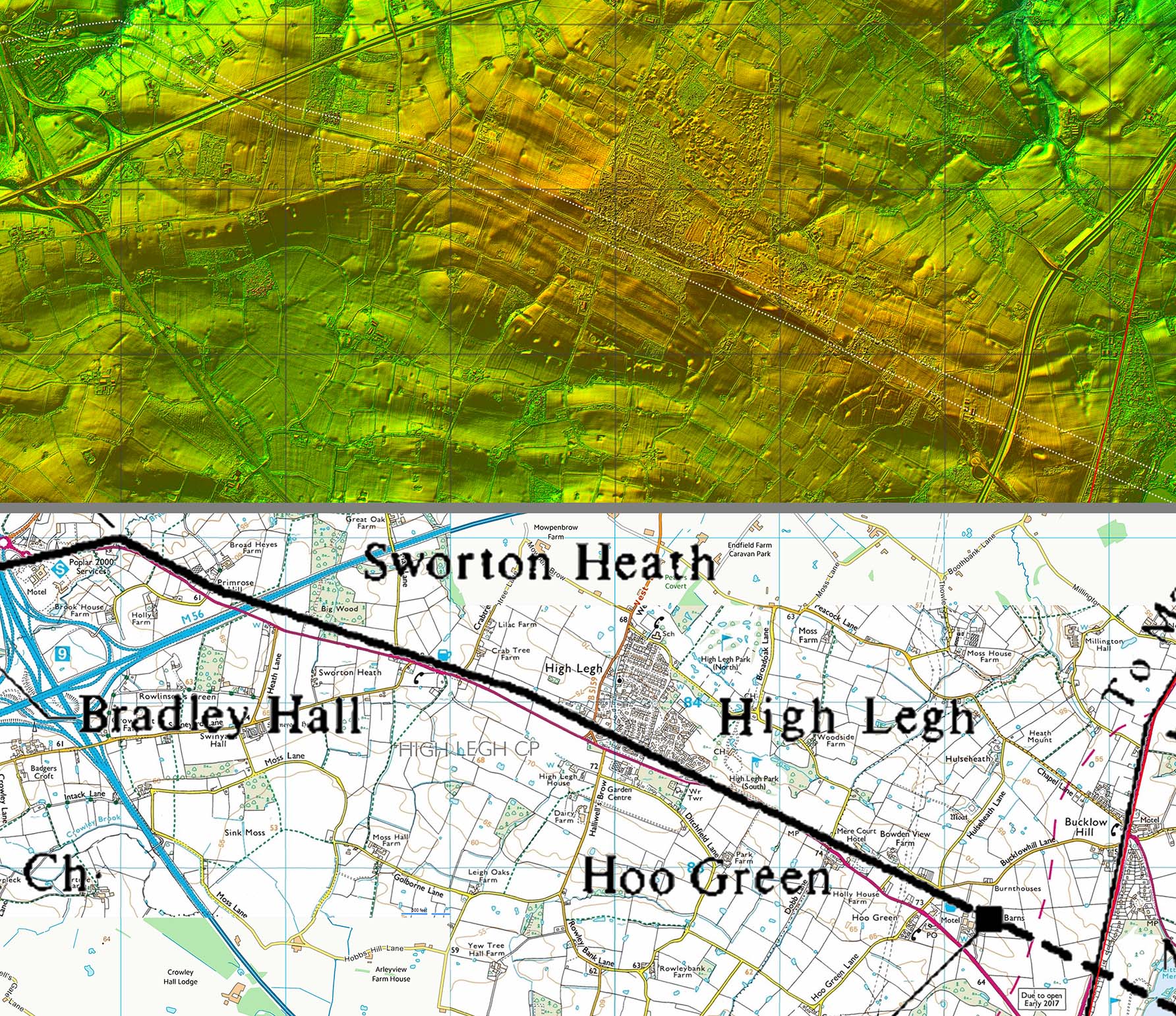
Route Map 2 - Redbank Bridge to Mere This stretch basically follows the A50 modern road or just to its left (north-east). Mere Bypass A556 crossed the supposed line but during contruction of the new road no trace was observed. Again nothing in the lidar imagery supports this road.
|
Click for larger view |
 |
|
|
|
Last update: December 2021 |
© David Ratledge & Neil Buckley |